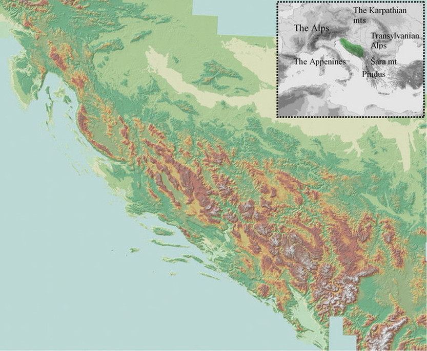
Map 1
The Physical map of the Dinaric Alps and position on the map of Europe But dont expect to find very high summits here, especially like those in the European Alps - the highest peak of Dinaric Alps is Maja Jezece / Maja e Jezercës (situated in Albania) in Prokletije / Bjeshkët e Nemuna mountain range, which is 2,694 m high.
The height of the majority of the mountains is between 1,000 and 2,000 meters, except the highest central core of Dinaric "triangle" where the most of the summits are between 1,900 and 2,600 meters high. But because of the other factors, even the "lower" areas of Dinaric Alps (which also includes high karstic plateaus), are mountainous in their character. Also, despite the word "Alps" in their name, in the most areas of Dinaric Alps, do not always expect to find a classical Alpine scenery like sharp mountain ridges between narrow glacial valleys, green grassy slopes and valleys, coniferous forests and picturesque villages with high Gothic spires. 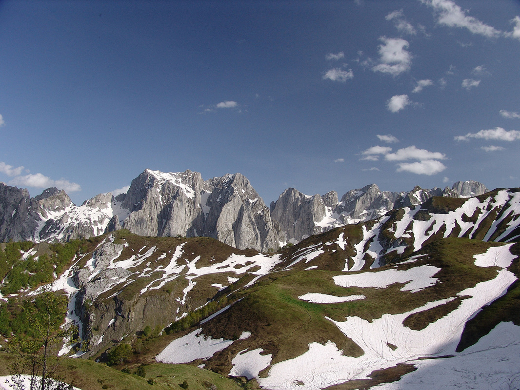
Title Photo: Prokletije (Bjeskhët e Nemuna, in Albanian)
The vast mountain group of Prokletije (Accursed mountains, in English), the highest part of the Dinaric Alps, is still considered as the wildest mountain range in Europe. |
VIA DINARICA
THE PARTNER OF THE DINARIC ALPS PAGE The goal of Via Dinarica is to develop a sustainable mega-trail that promotes, preserves and integrates the natural and cultural heritage of the Dinaric Alps region.
Dinaric Karst Caves – Richest In Species – 70% Indigenous To Croatia
By Marianne van Twillert, in Total Croatia News, March 2nd, 2024 A gastro tour off the beaten path By Marianne van Twillert, in Living in Montenegro, October 3rd, 2023 Les Alpes dinariques, des montagnes magnétiques By Hubert Prolongeau, January 21st, 2023 Adriaticaves, protecting the caves between Italy and the Balkans By Marco Ranocchiari, Osservatorio Balcani Caucaso Transeuropa, October 14th, 2022 Step aside, Dutch people. Montenegro is the tallest nation on Earth By Frank Jacobs, Big Think, August 23rd, 2022 How Slovenia Became One of the Most Sustainable Countries in Europe By Balša Dragović, in Earth.org, July 13th, 2022 Early autumn in the Dinaric mountains By Domen & Sara, in Carniolicum Blogspot, September 1st , 2021 Croatia Declares Mount Dinara 12th Croatian Nature Park! By Donatella Pauković, in Total Croatia News, February 6th , 2021 Discover why the Accursed Mountains are Europe's most misunderstood region By Oliver Smith, in Lonely Planet, November, 12th , 2020 Exploring Nature Park Piva By Marianne van Twillert-Wennekes, in Living in Montenegro, September 26th , 2020 Dinara to Become Newest Nature Park in Croatia By Danila Rogulj, in Total Croatia News, May 17th 2020 Ten amazing facts about Orjen mountain Share Montenegro, April 10th, 2020 How carnivores are being given new life in Europe By Aurora Velez on Euronews.com, March 16th, 2020 Along the foothills of mount Rumija Living in Montenegro, February 5th, 2020 A salamander didn't move for seven years – and that's not that unusual USA Today, February 4th, 2020 Zagreb Zoo only one in the world with two rare species Croatia Week, January, 10th, 2020 Walk through the skies and get incredible views on Biokovo this summer Time Out Croatia, December, 30th, 2019 The 20 Best Hikes In Europe By Erin Green, on Much Better Adventures, August, 20th, 2019 Oskar Bauman First to Climb Bobotov Kuk on Durmitor in 1883 By Obrad Pješivac, on Total Montenegro News, July, 30th, 2019 EU allocates 8.4 mln euros to joint BiH, Montenegro projects on Xinhua, July, 10th, 2019 Old stone houses in Montenegro’s karst region on Living in Montenegro, June, 29th, 2019 Rivers, stones and legends: Walking the ancient paths between Bosnia-Herzegovina and Montenegro Francesco Martino, in Osservatorio Balcani Caucaso Transeuropa , June 25th, 2019 Lynx translocated to Slovenia and Croatia to save an endangered population Lewis White in Discover Wildlife, May 24th, 2019 A Journey to Bosnia and Herzegovina, Where Sleeping Beauty Awakens Sarah A. Khan in New York Times, May 20th, 2019 Escape the crowds: Hiking in Albania Active Traveller, March, 2019 A 2,000-km biking trail set to open in the Balkans Mala Mail, January 27th, 2019 Why the Alps you need to visit are actually in Eastern Europe By Alex Bresler, on Matador Network, January 17th, 2019 Why the Alps you need to visit are actually in Eastern Europe By Tharik Hussain, Lonely Planet, December 1th, 2018 Hiking a new mega-trail in the Balkans By Krithika Varagur, on The Guardian, October, 8th, 2018 Border walls aim to keep out migrants, but also threaten bears, deer, other wildlife By Kim Hjelmgaard, on USA Today, May, 24th, 2018 'Life on the edge of civilisation': hiking in Croatia's mountains By Kevin Rushby, on The Guardian, April, 14th, 2018 5 easy hiking tours in the hinterland of Montenegro on Living in Montenegro, March, 2nd, 2018 5 easy hiking tours on the Montenegrin coast on Living in Montenegro, February, 20th, 2018 Montenegro by Camper on Living in Montenegro, February, 13th, 2018 The Dinaric Alps – Magic of summer and winter seasons at Mountain Treskavica By Sabina, on The Wild One, January, 8th, 2018 Peaks of the Balkans: a 120-mile walking trail through Montenegro, Albania and Kosovo By Rudolf Abraham, on Evening Standard, October 30th, 2017 A cycling tour of the Balkans: two wheels, three countries, four days By Rob Penn, on The Guardian, October, 23rd, 2017 Europe's Most Romantic Road Trip Is Nowhere Near France By Laura Feinstein, on GQ, October 9, 2017 Just back from: Montenegro and Croatia By Christina Webb, on Loney Planet Blog, October 9, 2017 Culinary delights Of Montenegro By Marianne van Twillert, October 9, 2017 Via Dinarica mega-hiking trail – Omiška Dinara By Sabina, on The Wild One, October, 7th, 2017 An Insider’s Guide to Experiencing Sarajevo and Its Rich History Vogue , September 1, 2017 Authentic Adventure on the Kosovo-Albania Border By Bridget Nurre Jennions , July 31, 2017 A Cycle Tour Through the Balkans in Southeast Europe Means Real Adventure By Olivia Balsinger, July 31, 2017 Hiking and road tripping in Bosnia: How to avoid land mines By Mel Had Tea, July 31, 2017 Off the Beaten Path: From Sarajevo to the Croatian Coast By Katie Aldrich, July 29, 2017 Breathtaking Balkans: 3 Ways to Explore Kosovo By Sarrah Bennett, July 28, 2017 Beautiful Balkans: Montenegro, Off the Beaten Path By Bridget Nurre Jennions, July 21, 2017 Bosnia’s new cycle trail is a big ‘open-air museum’ By Liz Todd, on The Guardian, April, 25th, 2018 5 things you should not miss in and around Ulcinj By Marianne van Twillert, March 22, 2017 The Old Town of Budva By Marianne van Twillert, March 16, 2017 The Western Balkans' Via Dinarica Mega-Hiking Trail By Alex Crevar, March 15, 2017 The 22 Places to Go in 2017 - Via Dinarica By Mark Johanson on Men´s Journal, January 15, 2016 Aimed at Refugees, Fences Are Threatening European Wildlife By YALE Environment 360, December 15, 2016 The new Kelmend road (SH20) in Albania By Marianne van Twillert, December 13, 2016 7 things you should not miss in Shkodra By Marianne van Twillert, December 8, 2016 Exploring Old Montenegro In Autumn By Marianne van Twiller, 21.11.2016 Privatization plans threaten Montenegro’s national parks Euronatur, 17.11.2016 7 Most Attractive Waterfalls in Bosnia and Herzegovina By Adnan Bubalo, on Balkanvibe, 17.11.2016 5 Things You Should Not Miss In Lovćen National Park By Marianne van Twiller, 16.11.2016 Fall in the Devil´s passage By Life&Ventures, Balkanvibe, 9.11.2016 10 Most Beautiful Mountains in Bosnia and Herzegovina - Europe´s Wild Side By Adnan Bubalo, Balkanvibe, 6.11.2016 The Magic of Scadar Lake By Marianne van Twillert, 2.11.2016 Magic Dinaric forests By Carniolicum, 2.11.2016 Tips for future Via Dinarica thru-hikers By Reiske, 31.10.2016 Albanian Activists Mull Lawsuits to Stop Power Plants By Balkan Insight, September 22nd 2016 Durmitor Ice cave: Hidden winter in Montenegro By Ginger in Montenegro, September 18th, 2016 Canyon Nevidio, Exploring Montenegro By Ginger in Montenegro, September 12th, 2016 Thru-hiking the Via Dinarica: A True Adventure By Claire Leenen, on Balkanvibe, August 10, 2016 Durmitor, Škrka: Back to the mountain By Ginger in Montenegro, July 23rd, 2016 Mega Trail Revives Ancient Communication Routes in The Balkans By Rodolfo Toe, June 18, 2016 Opening of Via Dinarica long-distance hiking route celebrated with tying of alpine rope By Anna Tyler, Lonely Planet, June 15, 2016 Camper Tourism - A Promising Chance for Montenegro By Marianne van Twillert, June 14, 2016 Opening of White Trail within the Via Dinarica – a contribution to development of platform for sustainable tourism development and local economic growth project in BiH Inspired Travel: The Best of Bosnia and Herzegovina By Molly Harris, May 26, 2016 Lepushë: Hiking in Kelmend By Marianne van Twillert, May 9, 2016 5 bridges you should see in Montenegro By Marianne van Twillert, February 20, 2016 Bears of Bulldozers in Valbona By Catherine Bohne, February 11, 2016 Via Dinarica Trail - Forget the Beach, Discover the Balkan Road Less Travelled By andadventure.com, February 8, 2016 Peaks of the Balkans: Mountain Trekking in Albania, Kosovo and Montenegro January 5, 2016 Motorbiking Tara Mountain in Serbia By PrelevicM, November 5, 2015 Hiking on the via Dinarica to Montenegro and Maglić By Hiking in Finland, November 2, 2015. Peaks of the Balkans Trek: A Beginners Guide By Audrey Scott, October 8, 2015. The Via Dinarica: The World´s Best New Hiking Trail By Alex Crevar, October 5, 2015 The Five: Traditional Balkan Homes that host Travelers By Valerie Hopkins, September 28, 2015 Bosnians Mark Eid High up on a Mountain By Amel Emrić, September 24, 2015 The Perilous and Gorgeous World of Cave Photography By Taylor Glascock, September 10 2015 Peaks of the Balkans Mountain Trekking in Albania, Kosovo and Montenegro By Daniel Noll, September 4, 2015 Interview with Nëntor Oseku, the hiker which explores Albania each weekend By Alketa Halilaj, from Invest in Albania, June 19, 2015 From the heart of the Via Dinarica in Bosnia and Herzegovina By Olivia Burton, August 31, 2015 Via Dinarica 2015 - A short hike from Bosnia across Montenegro to Albania By Chris, August 13, 2015 5 Ways to Discover the Dinaric Alps By Findery, August 11, 2015 This Place May Have the Tallest People in the World By io9 August 11, 2015 5 Things You Don't Know About the Dinaric Alps By Reeta Laaksonen, August 13, 2015. 
National Geographic Traveler magazine announced its annual Best of the World list today, which highlights 21 must-see places to visit in 2017. The full list can be found in the December/January 2017 issue of Traveler magazine, and online now at NatGeoTravel.com/BestTrips2017.
One of those 21 higlighs is Via Dinarica, on Western Balkans
Top 5: The Best Nature Trips to Take This Year
National Geographic ´s travel writers have toured the globe to bring you five of their favorite nature destinations for 2017. Find inspiration in the jaw-dropping landscapes of Kauai and the primeval cloud forests of Ecuador. Hike the Via Dinarica trail in the Western Balkans, catch a glimpse of the world’s biggest cats in India, or explore the rugged peaks of Banff, Canada. Whatever you choose, a daring adventure awaits! 
The 22 Places to Go in 2017
By Mark Johanson Via Dinarica Why now: The Dinaric Alps are one of Europe's least explored mountain ranges. But these towering peaks in the Western Balkans will become much more accessible to foreign hikers in 2017 when, for the first time after years of development, the 1,200-mile Via Dinarica trail will be completely mapped with detailed stage information. What to see: This spectacular new hike is, at its heart, a cultural corridor that links together ancient trading routes and more recent military paths through seven countries along the Balkan Peninsula. Expect astounding views of the Adriatic Sea and remote stays with isolated communities who still practice many old-world traditions. |

Photo above: Bogićevica
Bogićevica area in Montenegro in the Dinaric mountain chain Prokletije - here on the photo is katun Bajrovića (or Hridski stanovi). In the Dinaric area the word ´katun´ today has predominantly significance a temporary, seasonal shepherds´ settlement high in the mountains, where the shepherds come in summer with their herds, because of the abundance of fresh grass there.
Bogićevica area in Montenegro in the Dinaric mountain chain Prokletije - here on the photo is katun Bajrovića (or Hridski stanovi). In the Dinaric area the word ´katun´ today has predominantly significance a temporary, seasonal shepherds´ settlement high in the mountains, where the shepherds come in summer with their herds, because of the abundance of fresh grass there.
|
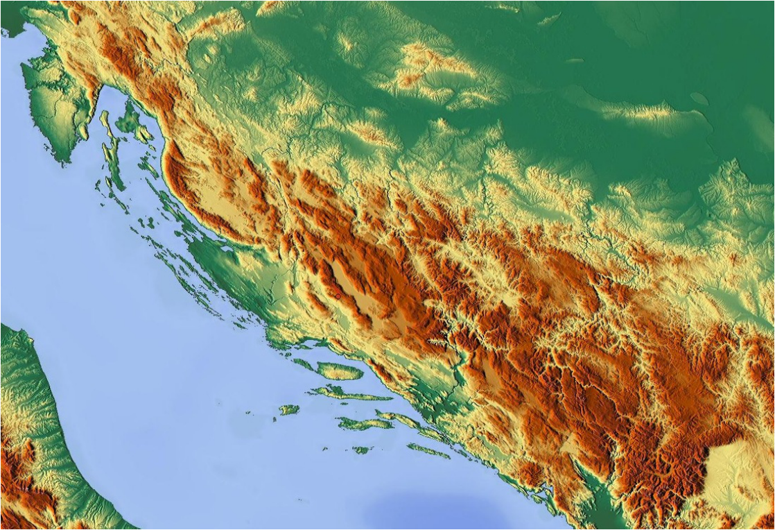
The most frequent geomorphological features you could experience in the Dinaric Alps are rugged mountains, composed of limestone and dolomite, high karstic mountain plateaus carved by river canyons, and mountains or summits rising from the plateaus. Furthermore you will find a mixture of mountaineous / alpine, continental and also of mediterranean climate and vegetation, as well as the same variety of cultural influences (Mediterranean, Central European, Eastern/Oriental and of course, Dinaric/Balkan). Among the mountains you will find churches, mosques and orthodox monasteries, deep dark mixed forests still inhabited with biggest carnivorous like bear, lynx, wolf or wild cat, still active shepherds´summer cottages or coastal sea-resorts and fishing villages. From summits of Dinaric Alps you can experience moon-like rocky karstic countrysides, full-green grassy or forested undulating hills and river valleys or magnificent views on azure-blue Adriatic sea and its islands where the chain hits the coast. Sometimes the contrasts are striking and after a drive through just a 500 m long tunnel you could find yourself literally in a different climate and vegetation zone.
But there is no sharp limit, because as well as you can find the elements of karstic relief in southern limestone Alps (especially the Julian Alps), so you could also find Alpine-like sharp mountain ranges, glacial lakes and other glacial features in some areas of Dinaric Alps like in Montenegro and in Bosnia&Herzegovina, and even gothic church spires in parts of Slovenia, Croatia and Bosnia&Herzegovina. Thick Dinaric karst (so called holokarst) is unique, covering more than half of the area of the chain, and it is said to be the largest of a kind in the world, with around 130 karstic fields, at least 15,000 known speleological objects and many other characteristic geomorphological and speleological features. "Thanks" to intensive karst formations, also, Dinaric mountain regions are still much inaccessible and inhospitable. Despite high annual rainfall the SE parts of the Chain have few surface watercourse, because water quickly sinks underground into the crevices and cavities in the limestone. This seems to be almost baren area (so called bare karst or uncovered karst), but people, animals and plants still live and survive here, and it is interesting and amazing way of life. Further inland off the coast and behind the rocky karstic area of uncovered karst, on high karstic plateaus or eastern faces of the mountains where the limestone gives it way to other kinds of rocks and soil, there are regions of huge expanses of forests, throughout the Dinaric Alps, from Slovenia and Croatia to Bosnia, Montenegro and parts of Serbia. This is thegreen or covered karst, so called because the karstic processes are taking place under the layer of humus/soil and vegetation. Because of their dominant NW-SE direction and the lack of adequate low-laying mountain passes, the Dinaric Alps were previously (and still are today), a strong barrier to receive outside influences as well as the barrier to travel from the coast to the interior and vice-versa. The main passes that traverse Dinaric chain are: Postojna Gate (Postojnska vrata; in Notranjska region in Slovenia; 606 m), Vrata (in Gorski kotar region in Croatia; 850 m), Knin Gate (Kninska vrata; in Dalmatia region, Croatia; appx. 700 m), Vaganj (Dalmatia and Bosnia regions; 1137 m), Ivan-Saddle (Ivan-sedlo; between Central Bosnia and Herzegovina regions; 967 m), Čemerno (between Eastern Bosnia and Herzegovina region; 1329 m), Crkvine (1,045 m) and Čakor (both in Montenegro; 1849 m). This inapproachability, but also the position between central parts of the Mediterranean and Central and Eastern Europe have influenced the peoples living in the area. During history this areas witnessed many migrations, invasions, liberation fightings, bloody wars, revolutions and rebellions. And even the division line between the Western and the Eastern Roman Empires (from 4th ct. AD) passed through these mountains, as well as the division line between Eastern and Western churches after 1054. AD disunion (The schism). And after this divisions and all other events throughout the history, the peoples here so intermingled that there are many parts of the Dinaric Alps with small dispersed enclaves of different nations, cultures and religions - the situation many compare to a leopard´s skin. Such rough and tough living conditions influenced to "development" of "special kind of people" that even the sociologist call "Dinaric race", for those people living in different parts of the Dinaric chain, share some similar characteristics (biological as well as ethnological - music, habits, folk-tradition heritage, shepherd's lifestyle etc.) - no matter from which nation they originate. The region is sparsely populated, overall, economically weak and culturally backward in most of the areas. SELECTED LITERATURE:
|
Small Photo Gallery |
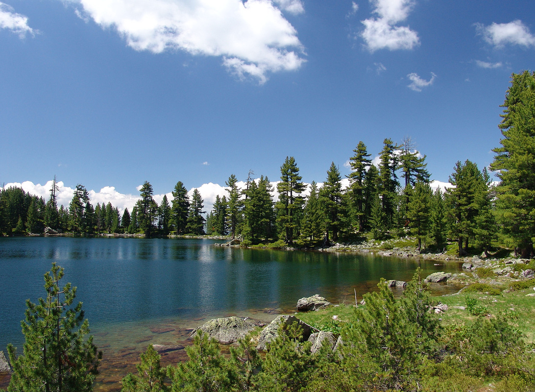
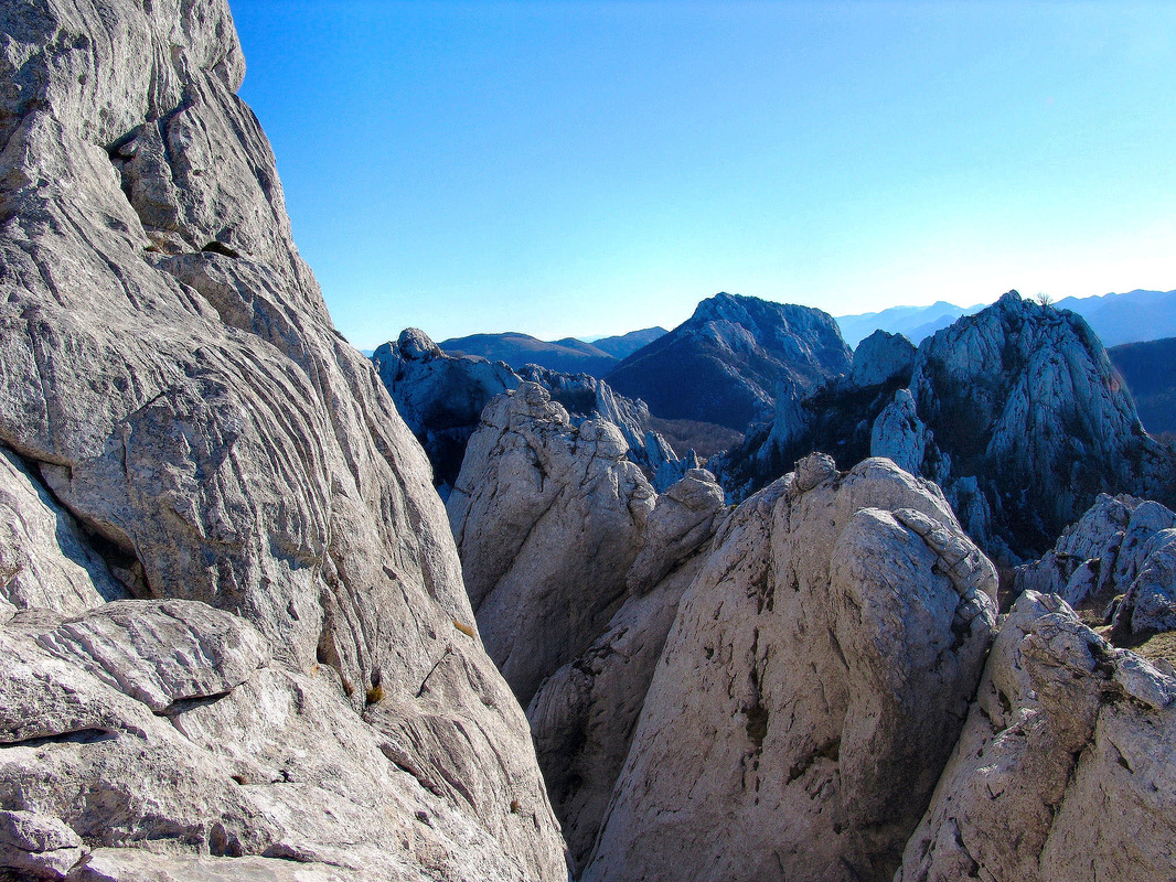
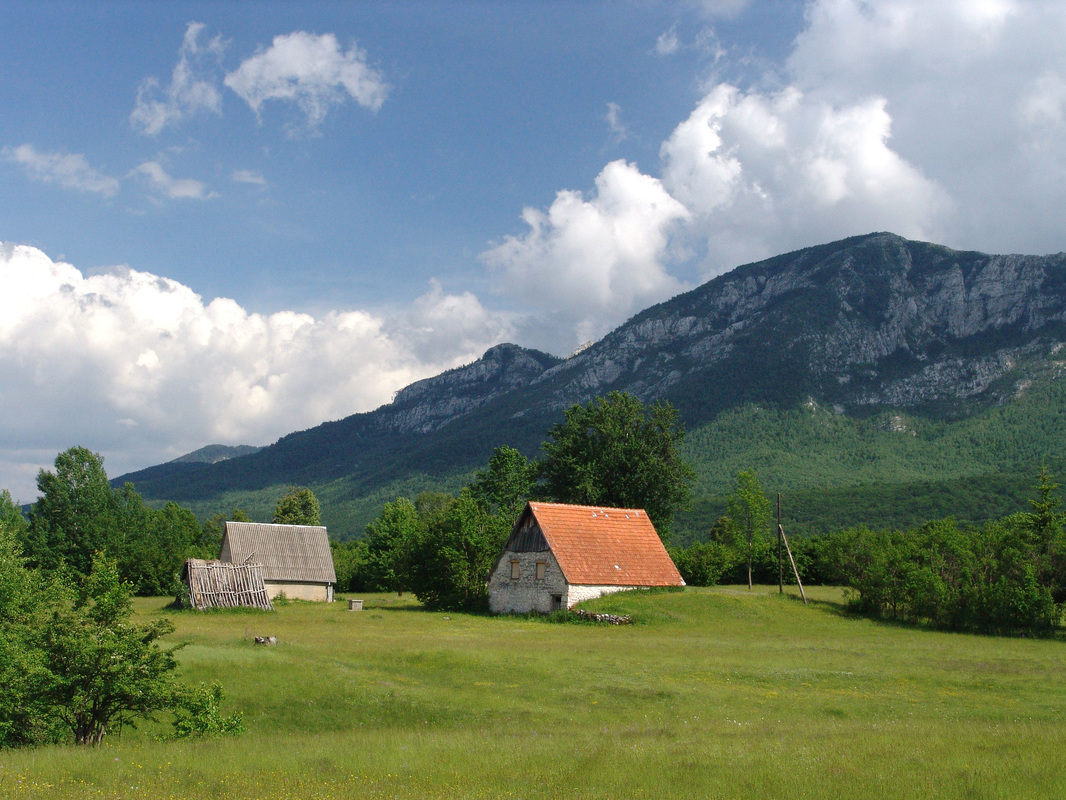
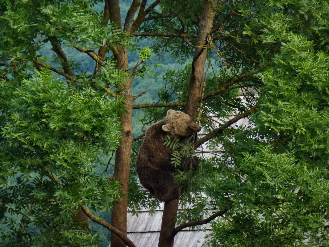
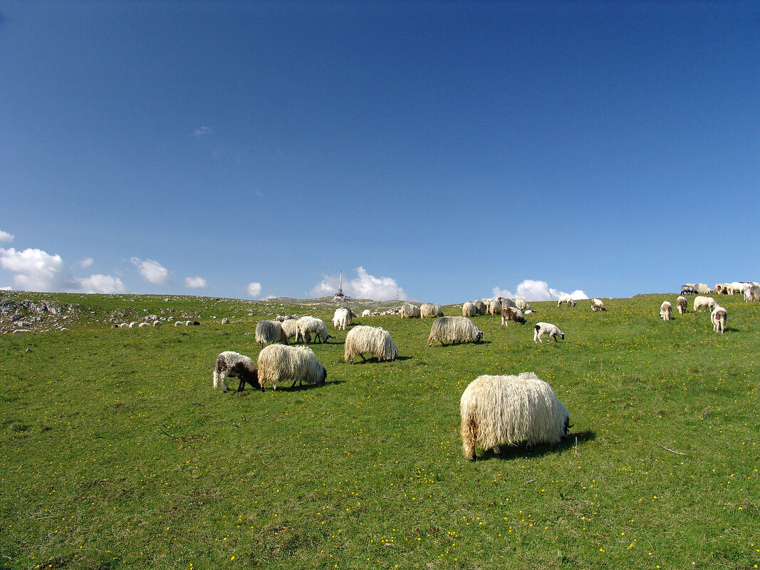
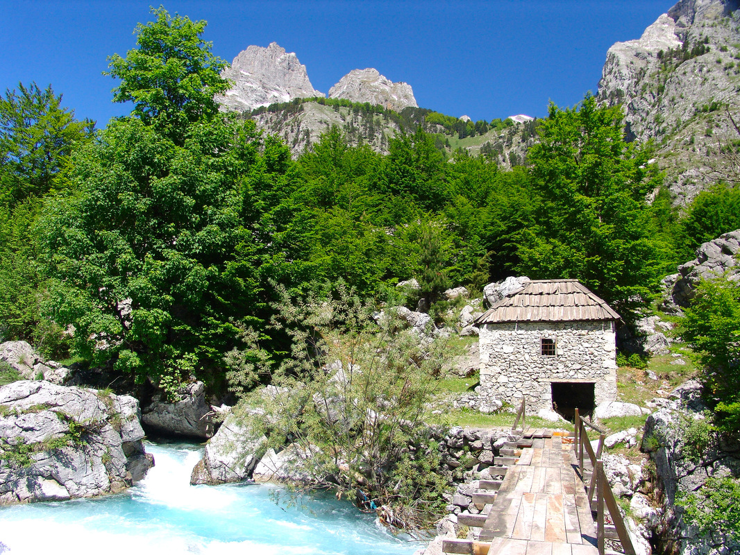
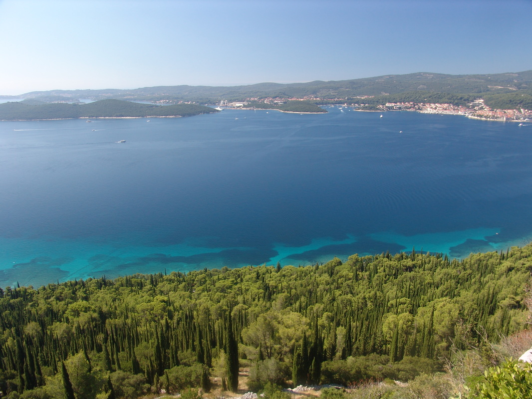
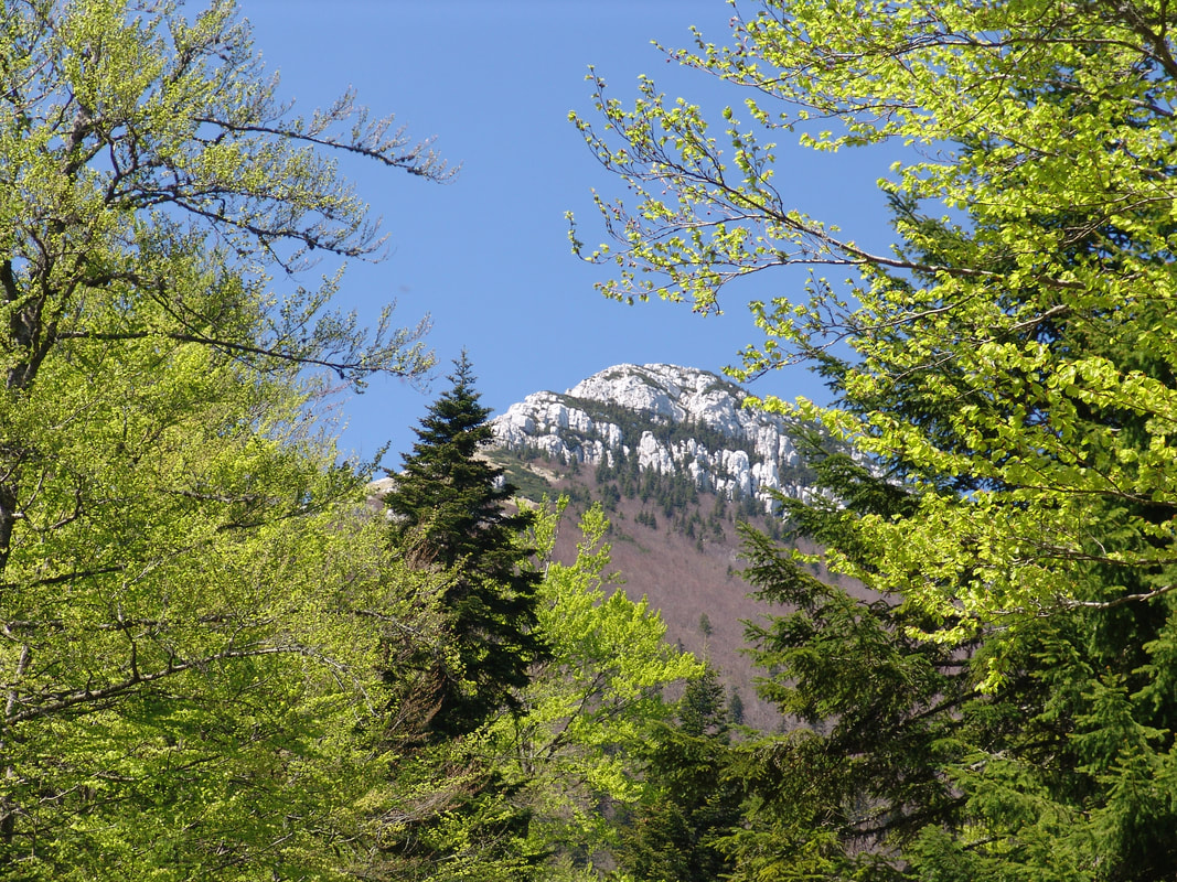
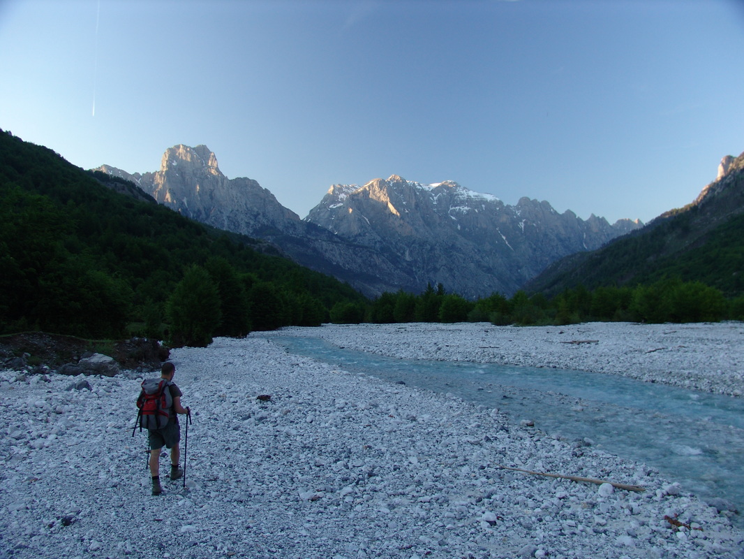
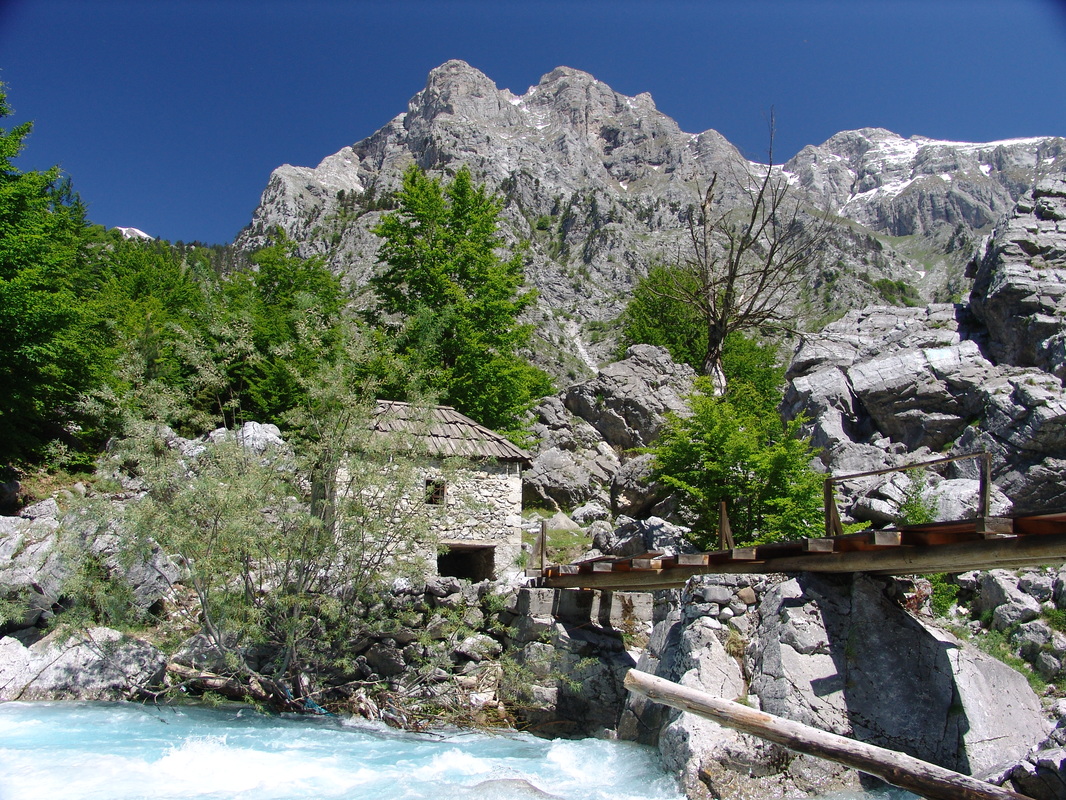

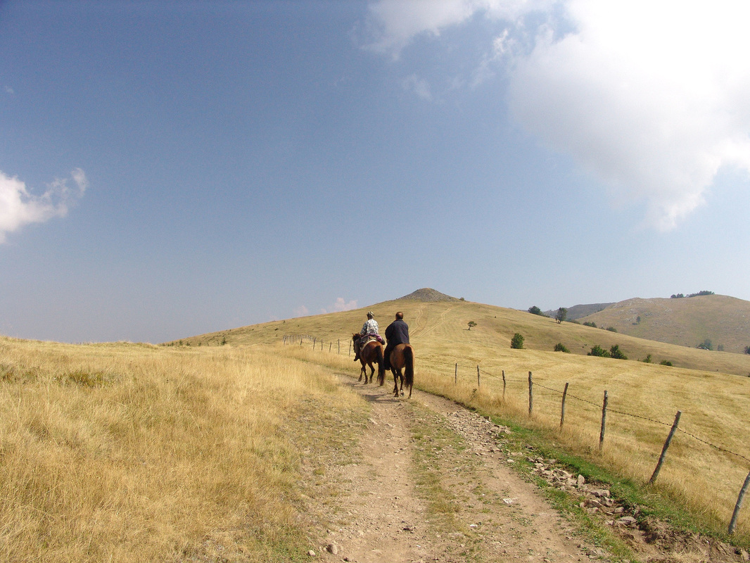
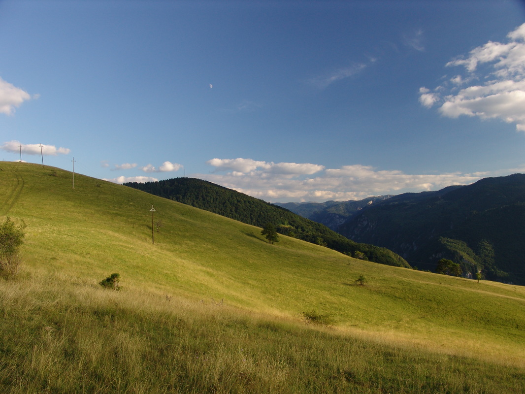

Photo above: Vlašić mountain
Rounded, mild relief forms covered with vast pastures and coniferous forests cover this mountain massif in Central Bosnian region.
Bosnia and Herzegovina
Rounded, mild relief forms covered with vast pastures and coniferous forests cover this mountain massif in Central Bosnian region.
Bosnia and Herzegovina
The Name
The mountain chain was named after Dinara mountain in Croatia and Bosnia&Herzegovina. Although it is not the highest mountain in the Dinaric Alps, Dinara mountain (massif) is centrally located and one of larger elongated mountain ranges which also shares many of the main characteristics of other mountains and ranges in the Dinaric Alps, including characteristic NW-SE direction. According to some beliefs Dinara itself got its name after an ancient indo-european Illyrian tribe Dindari that lived on its eastern slopes (in Bosansko Grahovo, Glamoč and Kupres area) before and during the Roman conquest of the area.
The name in different languages:
✹ Dinaric Alps / Dinarics / Dinaric mountains (English)
✹ Dinarisches Gebirge (German-Deutsch)
✹ Alpes Dinariques (French-Français)
✹ Alpi Dinariche (Italian-Italiano)
✹ Dinarsko gorstvo / Dinarsko gorovje (Slovenian-slovenščina)
✹ Dinarsko gorje / Dinarske planine (Croatian-hrvatski, Bosnian-bošnjački, Serbian Latin-srpski latinica, Montenegrin Latin-crnogorski latinica)
✹ Динарско горје (Serbian Cyrillic-српски ћирилица, Montenegrin Cyrillic-црногорски ћирилица)
✹ Maleve Dinarike / Masiv Dinarik (Albanian-Shqip)
✹ Dinári-hegység (Hungarian-Magyar)
✹ Динарските Планини (Macedonian)
✹ Динарски планини, Динарски Алпите (Bulgarian/Български)
✹ Dinárské hory, Dinárské pohoří, Dinaridy (Czech-Česky, Slovak-slovenčina, slovenský)
✹ Alpy Dynarskie, Góry Dynarskie (Polish-Polski)
✹ Alpii Dinarici, Alpi Dinari (Romanian-Română)
✹ Динарски планини and Динарските Планини (Bulgarian-Български)
✹ Διναρικές Άλπεις (Greek-Ελληνικά)
✹ Dinar Alpleri, Dinar daglari (Turkish-Türkçe)
✹ Alpes Dináricos (Spanish-Español)
✹ Alps Dinàrics (Catalan - Català)
✹ Alpes Dináricos (Portuguese-Portugues)
✹ Alpes Dináricos (Galician-galego)
✹ Dinarische Alpen (Dutch-Nederlands)
✹ Dinaryske Alpen (Frisian-Frysk)
✹ Dinariske alper (Danish-Dansk)
✹ Dei dinariske Alpane (nyorsk), De dinariske alper (bokmål)(Norvegian-Norsk)
✹ Dinarų kalnynas (Lithuanian-Lietuviu)
✹ Dinaarinen Alpit (Finnish-Suomi)
✹ Dinaari mäestik (eest.)
✹ ם׳רנ׳ךה ם׳פלאה (Hebrew-עברית)
✹ Дінарсъкі Альри (Ukrainian-Українська)
✹ Динарски планини (rus.)
Note: If you know the name in your own language, please, let us know! Please, use the contact form at the bottom of this page.
Central Velebit
Hiking along around 140 kilometer long Velebit massif offers amazing views of the Adriatic sea and its islands, as well as its mountainous interior. Photo shows a non-paved road near the village of Baške Oštarije, situated on a mountain saddle that separates the Central Velebit from the Southern Velebit. Bellow the road lies a field where the hamlet of Stupačinovo is located and behind it the peak of Badanj (1164 m). In continuation to the first field further away (to the left) lies the bigger field Prpić polje (polje = field) with the hamlet Prpići.
Croatia
The Area and its Borders
|
Starting from theirs´ northwest, Dinaric Alps rise over Furlany (Friuli/Furlanija) lowlands in Italy, and the border line of the Dinarics (see Map 2) continues eastward to Slovenia, around the town of Tolmin in Soča/Isonzo river valley, further along river Idrijca and southern edges of Julian Alps and theirs´ pre-alpine highlands, Idrijsko hribovje (Idrija hills) and Cerkljansko hribovje (Cerkno hills) which share both Alpine and Dinaric characteristics.
The borderline of Dinaric Alps then continues over towns of Logatec and Vrhnika in Central Slovenia, cuts through Ljubljansko barje (the centrally located field where Ljubljana, the capital of Slovenia lays), then follows river valleys of Temenica and Krka, through Dolenjska region in Slovenia, to meet Sava river in Krško polje (Krško field) - almost following all the way the route of Ljubljana-Zagreb highway. After reaching Sava river in Slovenia the borderline of Dinaric Alps area follows the Sava river basin in eastern direction for more than 400 km (250 mi) through Croatia and touching the northern borders of the state of Bosnia Herzegovina. On this section almost everything south of Sava river belongs to Dinaric Alps mountain system and peri-Dinaric (also in use: peri-Pannonian, or sub-Dinaric) heights, except of some geologically older mountain structures (old Pannonic system), like Prosara and Motajica mountains in northern Bosnia as well as Cer mountain in western Serbia. 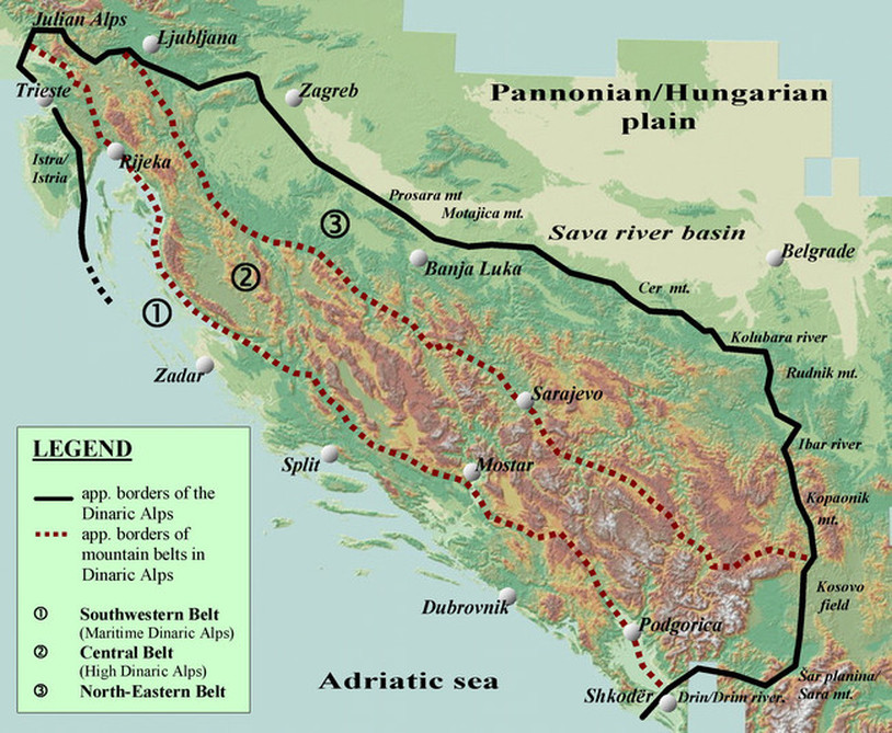
Map 2
Borders of the Dinaric Alps and the internal division into three parallel belts 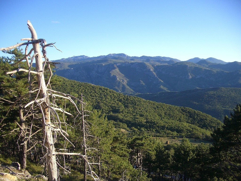
Orjen massif
Bijela gora, the mountain area in Orjen massif, at the border between Montenegro and Bosnia and Herzegovina. Orjen is the highest mountain massif in the Maritime Belt of the Dinaric Alps. After Sava river reaches Serbia proper, the borderline turns southwards along Kolubara river, over the town of Ljig, western foothills of Rudnik mountain, along rivers Dičina and Zapadna (Western) Morava then following Ibar river canyon for a longer stretch, east of large Kopaonik mountain massif, until it reaches the field of Kosovo (Kosova, in Albanian) and Sitnica river. Now we are in contact-area of geologically younger Dinaric Alps and older Rhodope mountain system. The borderline passes over mountains of Čičavica (Çiçavica or Bjeshkeve te Çiçavices, in Albanian), Goleš (Bjeshkeve te Goleshit, in Albanian) and Crnoljeva (Carralevë or Mali i Carralevës, in Albanian) which separate Kosovo from Metohija field (which is - unlike Kosovo field - Dinaric, settled at the foothils of Prokletije/Bjeshket e Nemuna range). Further following the borderline along Drim/Drin river through northern Albania and encircling Prokletije from SE and S we get to the city of Shkodër (Skadar, in slavic languages), close to Scutari lake (Skadarsko jezero). River Bojana/Bune that takes away the waters from Drim and the Lake into the Adriatic sea makes the southernmost limits of Dinaric mountain system. Further back, in NW direction, the Adriatic sea borders the Dinaric Alps. All the coast and islands of eastern Adriatic belong to Dinaric system, except two tiny islands in Dalmatia (Croatia), Jabuka and Brusnik which are volcanic by origin. Another exception is western half of Istria peninsula in Croatia and Slovenia which differs in geological origin from Dinaric system. Following the borderline of Dinaric Alps, passing through a half of Istrian peninsula we get to the important area (the explanation in other following sections) called Kras in hinterland of Trieste/Trst/Triest, and come back to Furlany plain. |
Society speaks and all men listen, mountains speak and wise men listen. "THE PHENOMENON OF KARST" /Trailer/ Zabiokovlje, Croatia
Author: Boris Krstinic; Posted: 1.2.2014. Description: Trailer for the TV series "The phenomenon of karst" filmed 1999th and 2000th, Krstatice village, municipality Zagvozd, Croatia. Many thanks to the residents Krstatice to assist in the realization of this project. GIZ: New Beginnings. Northern Albania – A Region Discovers its Treasures.
Author: GIZ; Posted: 25.1.2016. Description: Biodiversity – Opportunities for People and Nature. Natural and agricultural biodiversity (agrobiodiversity) improve the livelihoods of rural populations. In the beautiful setting of the Northern Alps, farmers are rediscovering the value of native crops and breeds to provide fresh regional produce to tourists who come to hike, climb or otherwise explore and discover this unique region. |
Prokletije (Bjeskhët e Nemuna)
Thethi, or Shala river valley in northern Albania, surrounded by the highest mountains of the Dinaric Alps.
Albania
Thethi, or Shala river valley in northern Albania, surrounded by the highest mountains of the Dinaric Alps.
Albania
Physical Map of the Dinaric Alps
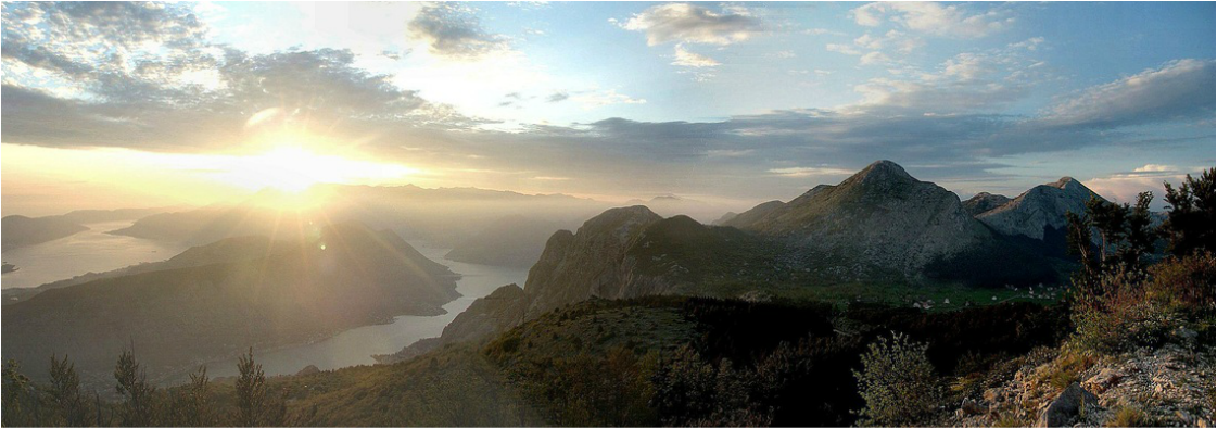
Boka kotorska
Boka kotorska bay (Bay of Kotor), seen from the slopes of Lovćen mountain, in Montenegro
Boka kotorska bay (Bay of Kotor), seen from the slopes of Lovćen mountain, in Montenegro
Bogićevica mountain area
Montenegro, Kosovo, Albania
Montenegro, Kosovo, Albania
Geology and Tectonics
|
The Dinaric Alps were developed during Tertiary thrusting, which was the most intense in middle Tertiary during Alpine built-up (orogenesys).
Overall, the main Alpine chains of Europe resulted from the subduction of Tethyan oceanic crust followed by a continent collision between African and European lithospheric plates. The Alpine orogenesys was very complex and occurred in several phases from the middle Cretaceous to the Neogene, of which the collision between Europe and Africa was only one. Much of the earlier deformation in the Alps has been replaced by the later mountain building in the Tertiary. So it was the same with Dinaric Alps. Later in geological history, after middle Tertiary, the Dinarics were somewhat leveled by natural forces, but in later Tertiary and at the beginning of Quartenary they were built up again to today's heights, and this built-up still continues and the region is at risk for seismic activity. The tectonic activity is still present in the area and earthquakes are relatively common features, especially along fault lines. The Dinaric Alps lack in ores (minerals). The exemptions are mountains in Central and Northern Bosnia and some other isolated regions, where some of the mountains are not made of limestone alone, but of other or older rocks. 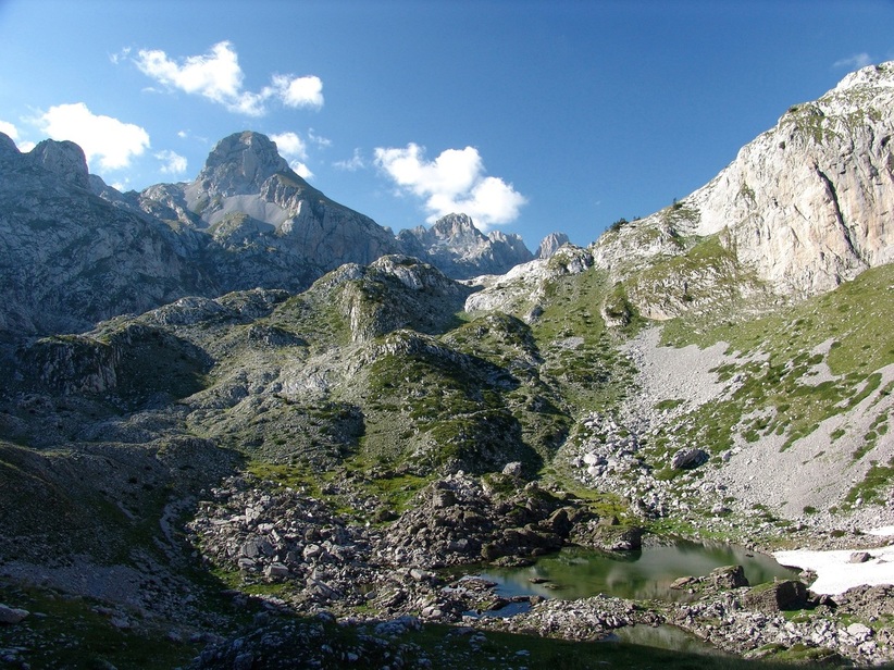
Prokletije (Bjeskhët e Nemuna)
Gropa Pejës depression in northern Albania, with small green-colored glacial Pejës lake (Albanian:Liqeni Pejës) as seen from Pejë mountain pass. This depression is situated just under Qatat e Verlla´s NW slopes. The peaks in the background are situated on Albanian-Montenegrin border. |
Little help - Geological Terms:
|
Prenj
Situated in Herzegovina region of the state of Bosnia and Herzegovina. Local people call Prenj "The king of the Bosnian-Hercegovian mountains."
Bosnia and Herzegovina
Situated in Herzegovina region of the state of Bosnia and Herzegovina. Local people call Prenj "The king of the Bosnian-Hercegovian mountains."
Bosnia and Herzegovina
Bijele stijene (White Rocks)
Ljuska (a nutshell, transl.) a cluster of limestone rocks, shaped by erosion, in NW part of Bijele stijene (transl: White rocks) in Velika Kapela mountain massif in Croatia. Some of the edges are really sharp as a knife!
Ljuska (a nutshell, transl.) a cluster of limestone rocks, shaped by erosion, in NW part of Bijele stijene (transl: White rocks) in Velika Kapela mountain massif in Croatia. Some of the edges are really sharp as a knife!
Dinaric Karst
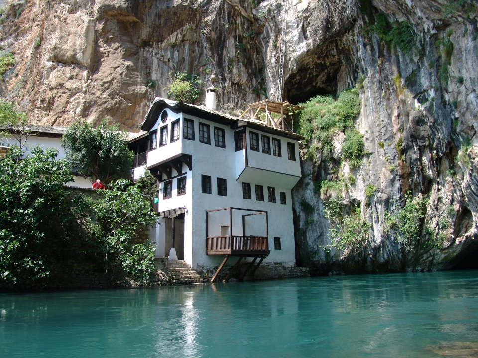
Vrelo Bune (Karstic spring of Buna river)
The Buna river is a short river in Bosnia and Herzegovina and it is a left bank tributary of the Neretva river. Its source (Bosnian: Vrelo Bune), a strong karstic spring, emerging from huge karstic cavern beneath a high vertical cliff. This region is specific for the diversity of its above-ground and underground hydrography. The source of the Buna river is the finest example of an underground karstic river. It's one of the largest and most beautiful springs in Europe, producing approx. 30 m3/s with extremely cold and clean water. In spite of high rainfall averages in many karstic areas in the Dinarics, the coastal side of the chain has few surface watercourses, because the rainwater quickly sinks underground into the crevices and cavities in the limestone. The more you move inland and to higher grounds the rainfall levels are still high and that supports the forming of dense forest covers (in Notranjska area of Slovenia, Gorski kotar area of Croatia, northern parts of Western Bosnia). Still further inland the limestone areas are less frequent. Locally, there are karstic areas even in Central and SE parts of the Chain, but they give place to other less-porous rocks (schists, grey-wackes, serpentines and crystalline rocks), which hold up surface flows and huge expanses of forests and other vegetation. This kind of karst is called covered, or green karst, because karstic processes are still taking place under the surface mantle of vegetation and humus-soil.
Closer to the coast the bare karst predominates. Here the forests were felled many centuries ago to provide the large quantities of timber required by the coastal towns and villages for shipbuilding and domestic consumption. Some of the largest quantities of timber were taken to Venice, Italy for millions of wooded pylons that hold basements of buildings in this "floating" city. After this deforestation the unprotected topsoil was washed away and the bare white limestone exposed, leaving the barren but magnificent landscape of the bare karst. This areas of bare karst are clearly seen from the Space as white spaces (especially the island of Pag, Dalmatian hinterland, lower Herzegovina and Montenegrin hinterland) contrasting to other wooded areas of Dinarics. As mentioned previously, the Karst got its name after Kras region in Slovenia and Italy (Italian Carso), a desolate stony and waterless region situated inland from Trieste. The processes of karst formation were first studied by geologists and geographers in this area and the adjective "karstic" has become a general term applied to any area where such processes have been at work (areas in Slovakia, China, USA etc.). The word is of Indo-European origin (kar meaning stone). Other terminology of the karst topography, such as doline, uvala, and polje, also originated in Dinaric karst area. 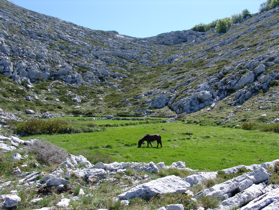
Biokovo
Biokovo mt. in Dalmatia region in Croatia; nice example of a small arable field in a karstic sinkhole, called dolac, or dô. Karst develops after dissolving of limestone in water, which contains carbon dioxide (CO2). This is generally a result of mildly acidic rainfall acting on soluble limestone. The rain picks up CO2 (which dissolves in the water) when passing through the atmosphere.
On the ground, the rain-water sinks into the limestone (which has more than 50 percent of kalcium carbonate - CaCO3) where it picks up more carbon dioxide and form a weak carbonic acid solution (H2O + CO2 -> H2CO3). This mildly acidic water seeps through and begins to dissolve fractures and bedding planes in limestone bedrocks (H2O + CO2 + CaCO3 -><- Ca (HCO3)2 - forming unstable calcium hydrobicarbonate). Over time these fractures enlarge as the bedrock continues to dissolve. Openings in the rock increase in size, and an underground drainage system begins to develop, allowing more water to pass through and accelerating the formation of karst features. This whole process is called the karstification. The process of karstification results in a topography with distinctive features and varieties, and overall the Dinaric Mountain region abounds in literally hundreds of examples of karstic landforms including sinkholes, doline(s), uvale(s), polja (fields), karst plains, dry valleys, karren (kamenice), pits, swallow holes (ponori), vertical shafts, disappearing streams, and springs. After sufficient time of water-action, complex underground drainage systems and extensive caves and cavern systems may form (the most of them with again deposited calcium carbonate in forms of stalactites and stalagmites). The roof of such subterranean cavities may collapse, forming funnel-shaped holes in the ground; the sides of these holes are then gradually leveled down, and a soil is carried into them by the heavy rain. These are the characteristic karstic features known as dolina (doline, plural) or swallowholes - conical depressions, usually ranging in diameter between 10 and 100 ft (approx. 30 to 300 ft), with their floors lying 30, 60 or even more feet below the surrounding ground level. Smaller dolines can also be formed at the intersection of enlarged clefts. In many areas in the karstic upland region (for example on Velebit and Orjen) one doline comes up against another, with only a narrow ridge between them; and when the intervening ridges in time disappear the dolines coalesce into a larger feature known as an uvala. Still larger depressions, surrounded on all sides by hills, are called polje (polja, plural). These very typical karstic features have usually very flat floors covered with alluvial deposits of fertile terra rossa. Polja (fields) are agriculturally important because they are basins of good soil in this otherwise barren upland region. At the edges of many poljes, set at an angle to the floor of the depression, underground rivers emerge, they flow through the polje and disappear again into a hole at the other end. Frequently, however, these holes - ponori (ponor, sing.) are too small to cope with the mass of water when the underground rivers are swollen by heavy rain, or after snow melting; the water then accumulates in the lowest part of the polje, and if the heavy flow of water continues the whole of the polje is transformed into a periodical lake. In some fields this flooding can last for several months. They are usually dry again by the beginning of summer, but if the autumn rains come early they may again be flooded in late summer, which produces lots of problems for people farming this small (and maybe, the only) parches of arable land. The villages and hamlets in which they live avoid the floor of the polje and stay out of reach of the water on the arid slopes around its edges which are not suitable for cultivation. 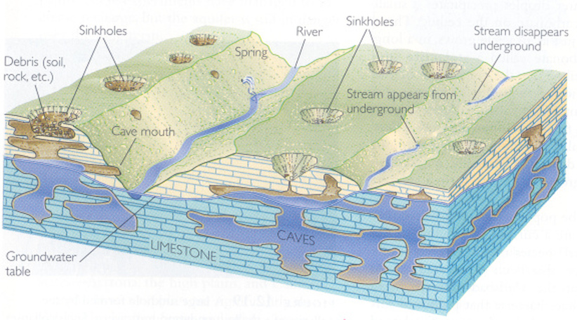
Karst landforms
Source: Frank Press & Raymond Siever, Understanding Earth, New York City: Freeman & Company, 1997, p. 308 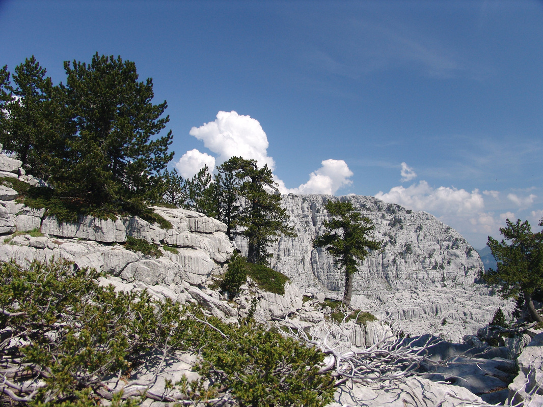
Maganik
Example of very karstic terrain is the rocky wall (50 to 150 meters high sides) of Trešteni Vrh (1980 m), seen in the background - in the mountain massif of Maganik (Montenegro). The ridge of that peak is about 800 m long and about 400 m wide. The water which sinks into the ground in the karstic uplands finds its way to another polje and lower laying land or the sea through underground channels. One of the largest such system is Pivka river system in Notranjska region of Slovenia, with more such subterranean "tunnel valleys" - one of them the famous Postojna Caves (other such rivers are river Lika in Croatia, Buna in Herzegovina, Reka river in Slovenia).
After their disappearance into a ponor many rivers re-emerge again in the form of karstic springs on the coast or even under the sea (vrulja spring). Along the the eastern Adriatic coast between Rijeka and Kotor Bay (Boka kotorska) only few rivers reach the sea in deeply, steep-sided canyons (Zrmanja, Krka (Dalmatian), Cetina and Neretva rivers). A normal surface drainage system develop in the areas of less permeable clay and marl which occur here and there in the limestone region, but as soon as the rivers reach limestone territory they disappear underground like the others. 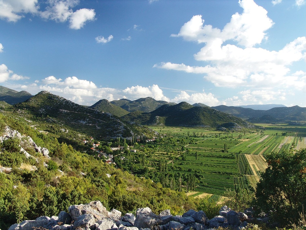
Vrgorsko polje
An example of a middle-size karstic field - polje (20 x 0.5 to 4 kms) in inner Dalmatia, Croatia
|
karst (kɑrst) noun;
karstic (karst′ic) adj. An area of irregular limestone in which erosion has produced fissures, sinkholes, underground streams, and
caverns. [after the German word Karst, a limestone plateau near Trieste (where geologists first studied karstic landscapes).] American Heritage® Dictionary of the English Language, Fifth Edition (Physical Geography) (modifier) denoting the characteristic scenery of a limestone region, including underground streams, gorges, etc Collins English Dictionary – Complete and Unabridged, 12th Edition 2014 Little help - Basic Terms on Karst: Sources used on Karst chapter: Baedeker´s; Yugoslav Encyclopedia, 1966; Mountains of Slovenia, Cankarjeva založba, 1989.

Karst features
Click on the photo to see a graphic on Karst features. ŽIVO! Life and Water in the Karst Region
Autor: Speleo House Datum objave: 8.9.2015. Description. This documentary is one of the many results achieved through the ŽIVO! project co-financed by the European Regional Development Fund. Postojna Cave is a 20,570 m long Karst cave system near Postojna, Slovenia. It is the longest cave system in the country as well as one of its top tourism sites. The caves were created by the Pivka River. ( Wikipedia )
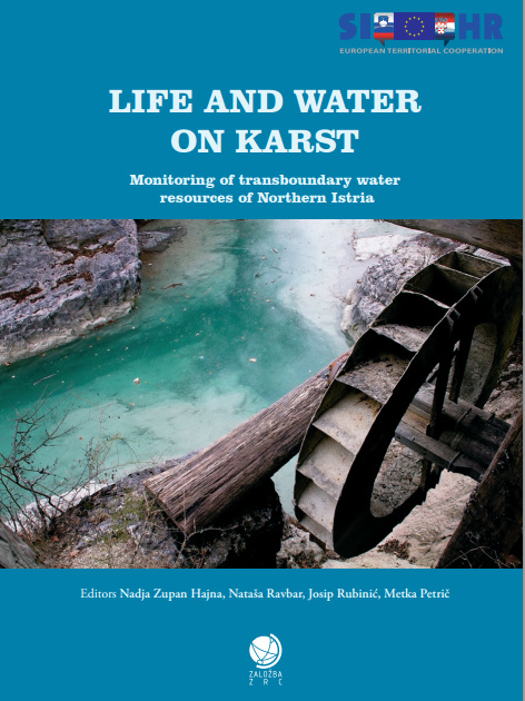
Life and Water on Karst (PDF)
Monograph - number of pages: 150, English The monograph is intended for the general public, and will be a good basis for planning life and water management in karst regions, and the dissemination of knowledge on waters in karst areas. The northern part of Istria in the border region between Croatia and Slovenia is a typically karst area. Water flow is for the most part underground and feeds karst springs, which are an important source of drinking water. The issue of water supply was the predominant subject of the research conducted under the ŽIVO! project. A monograph "Life and water on Karst" and a documentary film "Life and water in the Karst region" are among the project results. 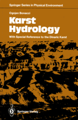
Karst hydrology with special references to Dinaric karst
OGNJEN BONACCI Language: English Publisher: Springer Verlag, Berlin, 1987. SUMMARY; Karst is characterized particularly by special landforms and sub surface drainage. The various actions of water result in numerous variations of surface and sub-surface karst forms. They also bring about distinctive geologic-morphologic forms, and more striking ly, specific flora and fauna. The scientific discipline of hydrology, although a long-established science, cannot easily be applied to karst regions with their very complex drainage system. A special approach is therefore necessary to understand and predict water circulation in these areas. This is the viewpoint we must adopt if hydrology is to solve the complex problems of karst phenomena. This book can be seen as the appeal of a hydrologist to experts from different scientific dis ciplines (geology, hydrology, geomorphology, geography, geo physics, meteorology, ecology, civil engineering, forestry, agricul ture, etc.) to collaborate towards a better understanding of karst areas. Evidently, karst phenomena have not been sufficiently and carefully studied worldwide. It is equally true that the first theories on water circulation in karst were developed according to ex periences in the Dinaric karst. This can easily be explained. In habitants in those areas had no place to which to escape, as was the case in other countries. |

Spring blossom in the mountains
The surroundings of Kapetanovo jezero (The Captains´s lake) in Moračke planine (Morača Mountains); southeast of the lake at approx. 1600 m altitude.
Montenegro
The surroundings of Kapetanovo jezero (The Captains´s lake) in Moračke planine (Morača Mountains); southeast of the lake at approx. 1600 m altitude.
Montenegro
Climate
|
The mountains of the Dinaric Alps are under influence of three basics types of climate.
The heights of the narrow coastal belt and the islands of the Adriatic are under influence of Mediterranean climate with hot dry summers and mild rainy winters. But higher and the highest mountains in the coastal area have more complex climate. Sunny slopes of those ranges are very hot in summer. Also, warm humid air that comes from the sea, very often crashes with colder air above those mountains, so the higher areas can have a lots of snow in winter and overall, the first rows of high ranges into hinterland (Orjen, Velebit, Gorski kotar), receive a huge amount of precipitation - yearly averages (some of the highest in Europe) are between 3000-5000 mm of precipitation (Crkvice on mt. Orjen have an average of 4640 mm, the absolute maximum in Europe). High mountains of Maritime zone and parts of the Highest Dinaric Alps are strong barrier for Mediterranean influences to penetrate further inland. On some places on the coast the influence of the Mediterranean climate is restricted to just few kms into inland, or less, because of the height of coastal mountain barrier - Velebit mountain, especially. In other areas, like river valleys (Neretva, Zeta) or lower mountain passes, warmer Mediterranean air penetrates further inland, away from the coast, and reaches the first rows of mountains in the Central Dinaric Belt. 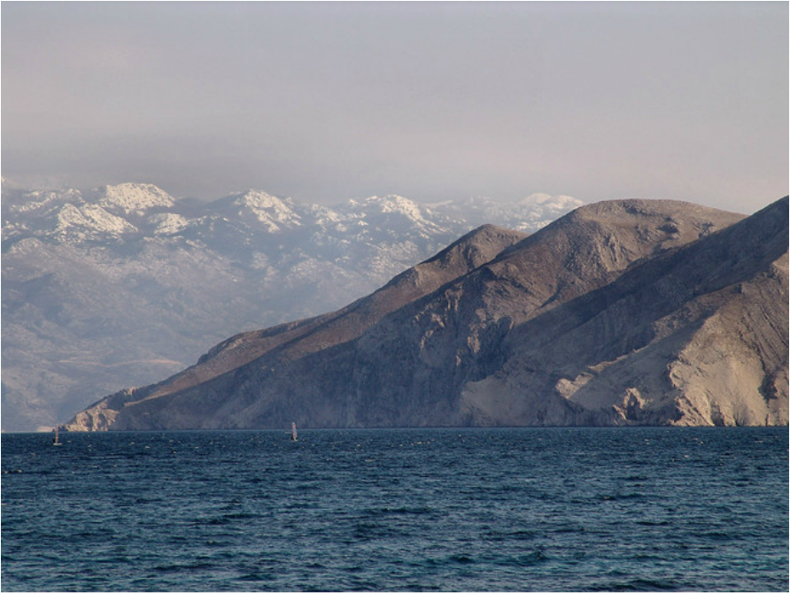
Velebit massif
Northern Velebit mountain (under snow) with mountainous - Alpine climate, as seen from Krk one of the islands of the Northern Adriatic with Mediterranean climate. The best example is relatively warmer climate of Lower Herzegovina all the way to the city of Mostar (some 40 km away from the coast) and the warm Mediterranean and cold Mountain and Continental climates crash very often over the mountains of High Herzegovina, north of Mostar (like Prenj mt.), which is know for its unpredictable weather conditions.
The most of the Dinaric Alps area has classical mountainous or Alpine climate with large rainfalls, short and cool summers and long winters with abundant snowfalls. In winter time the cold air descends from surrounding mountains into lower laying mountain fields and valleys. Those areas have lower winter temperatures than the mountains surrounding them. In summer-time the process is reverse, the bottom parts and the slopes warm up much faster than surrounding mountains. The lowest temperatures in the Dinarics, were measured not only on the highest mountain tops, but on some of the highlands in the area, especially those situated further away into land mass (so called mrazišta= frosty locations, like Pešter highland (Pešterska visija / visoravan, orig.), Igman plateau, Gorski kotar plateau, with record temperatures measured at -40°Centigrade and lower. Mountains on the northern edge of the Dinaric Alps and the lower laying areas of the North-Eastern chain have a mixture of mountain and continental climates (of Central-European or Balkan types), sometimes this climate is called moderate-continental and mountainous. Those areas have warm summers but also cold winters. 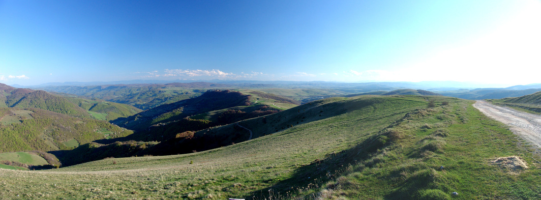
The Pešter plateau
(serbian, Пештерска висораван/Pešterska visoravan, or simply Pešter) is a karstic plateau in southwestern Serbia, in the Raška (or Sandžak) region. It lies at the altitude of 1150–1492 m. The territory of the plateau is mostly located in the municipality of Sjenica, with parts belonging to Novi Pazar and Tutin. The name of the region comes from the word pešter, which is an archaic term for cave. Pešter is famous for its microclimate, which is particularly harsh in the winter months. The lowest temperature in Serbia since measurements are taken, −39 °C (−38 °F) is measured at Karajukića Bunari village on 26 January 2006, beating the previous record of −38.4 °C (−37.1 °F) measured in Sjenica in 1954. 
Late spring on northern Velebit in Croatia
|
Prevailing winds along the eastern Adriatic coast [source: Croatian National Tourist Board, www.croatia.hr] Bora (Bura) is the strongest wind along the Adriatic coast, blowing with enormous strength in some locations, mainly in the northern parts of the Adriatic. It is a dry and cold downward wind, blowing in bursts from the north-northeast to the east-northeast direction. The direction in which the wind blows is mostly influenced by the configuration of the shore. The strength of bora is explained by the existence of warm air over the surface of the sea, and a cold layer of air above mountain ranges in the littoral, which cause a strong streaming due to equating of the pressure. Cold air tends to fill the void, which occurs due to the rising of the warm (lighter) air from the sea surface. Bora blows mostly in the winter. In the summer, it usually lasts for a day or several hours, while, in the winter, it can blow as long as 14 days. Sirocco (jugo, šilok) is a warm and moist wind which blows from the direction east-southeast to south-southwest. Its consequences are high waves and rain. Sirocco is a characteristical wind for the southern Adriatic, where it blows longer and stronger than in the northern part. In the summer, it usually blows as long as 3 days, and in the winter even as long as 3 weeks. The signs of the oncoming sirocco are the calm at the sea, weak changeable winds, dimness of the horizon, the increase of the temperature and moisture, and the gradual decrease of the pressure. Waves from the direction of the southeast become bigger. The landward breeze (maestral) is a daily, thermic wind blowing from the direction of the northwest, and it occurs as the consequence of the difference in the speed of warming up of the land and the sea. It is present from the spring to the autumn, and, during the day, it often changes the direction of blowing. The landward breeze is more present in the southern Adriatic than in the northern Adriatic, and it starts to blow earlier there. The stiff breeze (burin) is a wind blowing contrary to the landward breeze. It blows during the night from the direction of the north, north-east in the northern Adriatic, and in the southern Adriatic, from the east or south-east. It is the strongest before the dawn, and after that it stops soon. |
Selected video
|
|
I met the Slovenian bears
Posted: 21.3.2022. Author: Anja Robanke Description After some days at the Slovenianbears.com, I made this video. It was my first time seeing bears out in the wild 🐻 It was amazing. If you like to follow along with my life on the road and adventures, please subscribe to my channel. I also wrote a blog post/diary about these days. You can read it here: https://anja.robanke.dk/slovenian-bears Link to my shop: https://anja.robanke.dk/en/shop/ |
Valbona river
Valbonë or Valbona is a river in northern Albania with its source in Bjeshket e Nemuna / Proketije range at the southeasternmost end of the Dinaric Alps. On the photo Valbonë valley (Lugina e Valbonës, in Albanian) and river Valbona.
Albania
Valbonë or Valbona is a river in northern Albania with its source in Bjeshket e Nemuna / Proketije range at the southeasternmost end of the Dinaric Alps. On the photo Valbonë valley (Lugina e Valbonës, in Albanian) and river Valbona.
Albania
Rivers
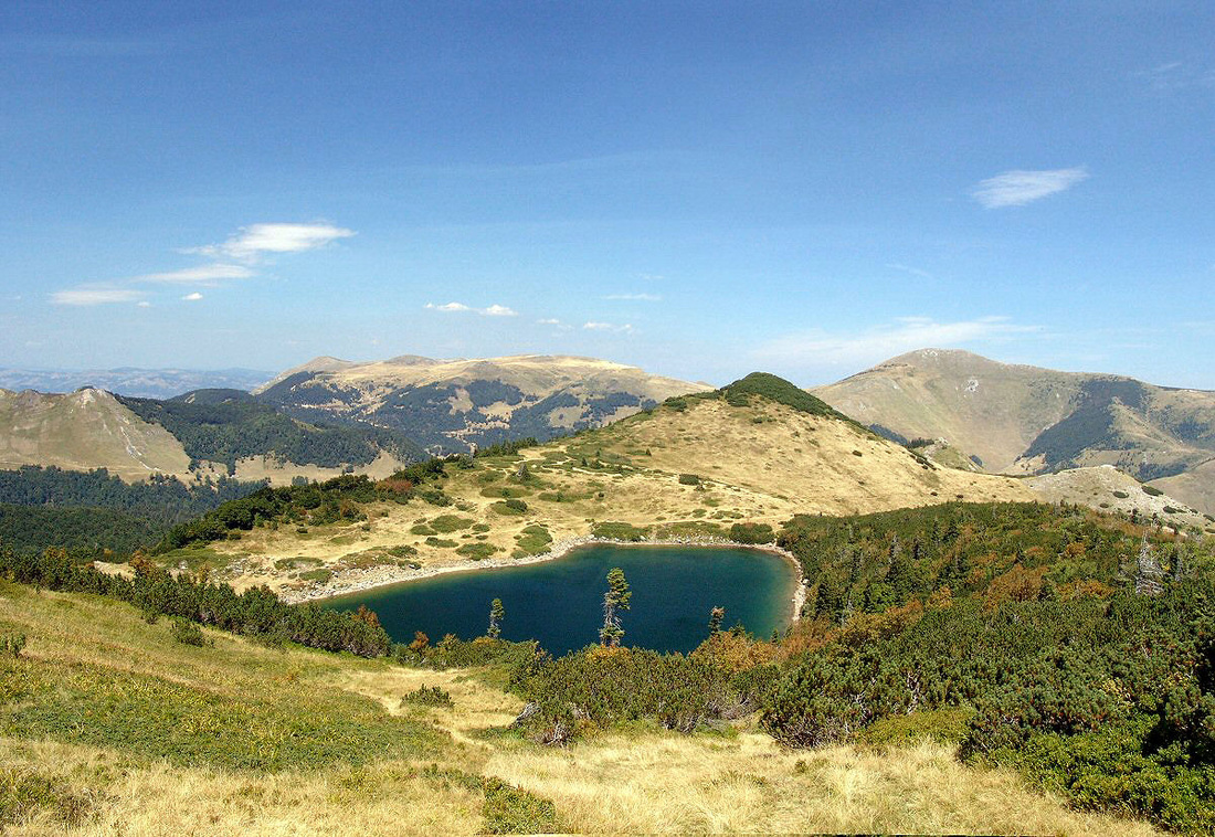
Bukumirsko jezero (Bukumir lake)
Situated in Žijovo (Žijevo, Kučke planine / Mountains of Kuči), a local mountain group in Montenegro, near Albanian border.
Montenegro
Situated in Žijovo (Žijevo, Kučke planine / Mountains of Kuči), a local mountain group in Montenegro, near Albanian border.
Montenegro
Lakes
|
There are more than 200 lakes throughout the Chain. They are of karstic, tectonic, glacial, travertine, fluviokarstic, or fluvial origin, and also the artificial ones, but the most of them are much smaller than 10 sq. km.
Ursulovačko jezero (Ursulovac lake)
Ursulovačko jezero is one of six glacial lakes on Bjelasica mountain massif in Montenegro. | |||||||||||||||||||||||||||||||||||||||||||||||||||||||||||||||||||||||||||||||||||||
|
Forest and bear country
The Kočevski Rog or Kočevje Rog (German: Hornwald) or simply Rog is a karstified plateau in the Kočevje Highlands above the Črmošnjice. The plateau is part of the traditional Lower Carniola region of Slovenia and of the Dinaric Alps. The highest area is the central part, with the 1099 meter high peak Veliki Rog. The plateau is densely forested what enables the survival of brown bears, wolves and lynx. (Slovenia) |
Nature Protection
Morphological, Climatic, Biological and other diversities, as well as Tourism and Ecological needs were the main reasons for protecting some areas in Dinaric mountain chain. And it is really striking how different those national parks and protected areas are in their character.
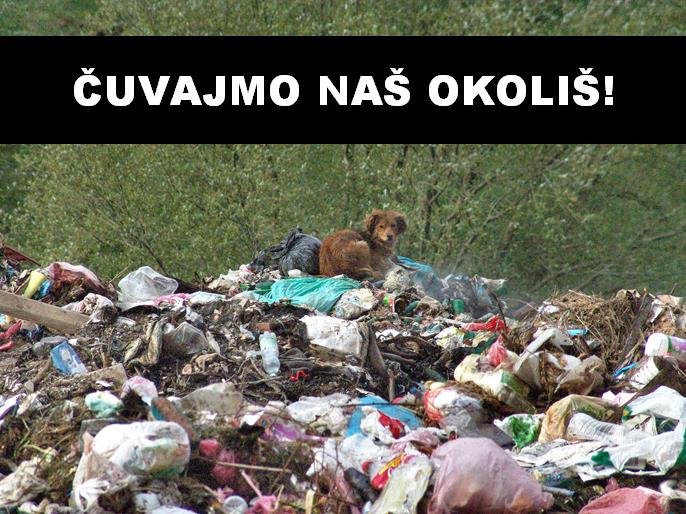
But sometimes, despite the intentions to protect the nature, there are some part in Dinarics (sociological and cultural reasons) where local people do not have very much active attitude in protecting their natural surrounding (trash dropping!), and the only reason why many mountaineous areas are still being preserved is shear underdevelopement and underpopulation in those areas.
The most of the states in Dinaric Alps have one or more national parks and strictly protected areas. Here is a review of the National Parks in the Dinaric Alps:
|
Balkan Lynx Recovery Programme 2005 - 2015
Date: 26.11.2015. Author: EuroNatur - Stiftung Europäisches Naturerbe EuroNatur - Stiftung Europäisches Naturerbe Description. The Balkan lynx is one of the rarest cats on Earth. Have a at look the conservation efforts in South East Europe conducted by an international NGO-alliance. Visit http://www.euronatur.org/Protecting-l... for further information. |
Krokar Virgin Forest
Date: 26.3.2020. Author: Description. The film Krokar Virgin Forest presents the largest old-growth forest reserve in Slovenia - the Krokar virgin forest on Borovška gora. In 2017 it was declared as an UNESCO natural heritage site. Forest genetic research has shown that this forest is one of the extremely rare glacial refugia of European beech. Production: RTV Slovenija. The English adaptation of this film was made within the LIFE LIFEGENMON project and made possible by the Slovenian Forestry Institute, Slovenia Forest Service and the Ministry of Environment and Spatial Planning of the Republic of Slovenia. Zavod za gozdove Slovenije TV Zavod za gozdove Slovenije TV |
Divje živali raziskujejo Kočevski gozd // Wild animals exploring the forest of Kočevsko
Autor: Kočevsko Datum objeve: 19.10.2023. Opis. Divji prebivalci Kočevske so ob prihodu hladnega vremena nazaj! Od skrivnostnega risa do igrivih medvedov, živali raziskujejo gozd, mi pa jih spremljamo pri njihovem vsakdanu. Pridružite se nam, da skupaj razkrijemo skrivnosti divjine in čudovite koščke Kočevske narave. Odpravite se na divji potep po naši skrivnostni naravi: https://www.kocevsko.com/sl/ogledi-in... Wild animals of Kočevsko are making a 'pawsome' appearance as cool weather rolls in! From the elusive lynx to playful bears, the forest is their stage, and we're capturing the show. Join us as we uncover the secrets of the wild in this stunning corner of nature. Visit Kočevsko to experience our wildlife and join us on an unforgettable Slovenia Unique Experience "Observing and Discovering Bears in Their Natural Habitat": https://www.kocevsko.com/en/tours-and... or another adventure: https://www.kocevsko.com/en/tours-and... Kočevsko, the Secret Forest of Slovenia https://www.kocevsko.com/ Facebook: / kocevsko Instagram: / kocevsko |
The List of national Parks in the Dinaric Alps
|
THE NAME
|
MAIN FEATURES
|
COUNTRY
|
|
Risnjak National Park
|
Unusual richness of natural phenomena caused by its position between Alps and Dinaric range, which causes different climatic, geological, petrographical, and other characteristics of the area; forest vegetation covers 98 percent of the Park; karst phenomena - sink holes, pits, springs, abysses; protected and endemic species of flora and fauna; presence of big mammals - bear, wolf, lynx, chamois; possibilities for recreation - trekking, mountain biking, tour skiing. Risnjak NP Link
|
Croatia
|
|
Plitvice Lakes NP
|
Established in 1949, enlisted in UNESCO - World Heritage List: 1979. Main features: diverse forest communities cover more than 75 % of the park area; unique karst phenomenon-between the mountain ranges of Mala Kapela and Licka Pljesivica there is a series of 16 lakes arranged as cascades, separated by travertine barriers; karst phenomena - caves, sinking zones, pits, ice caves; preserved forests of beech and fir, relic forest communities; high biological diversity -1146 plant species (72 endemic, 22 protected), 150 birds; habitats of big predators - bear, wolf, lynx, wildcat Specially protected areas: special forest reserve - virgin forest Corkova uvala. Plitvice NP Link
|
Croatia
Brochure Parks of Croatia
|
|
Northern Velebit NP
|
Numerous karstic phenomena and caving objects - deep pits, karrens, sinkholes; preserved forest communities; high biological diversity, plenty of endemic species; landscape diversity - picturesque valleys, pastures, rocks, screes; remains of traditional architecture - old summer lodgings Specially protected areas: strict reserve Hajdučki i Rožanski kukovi, special botanical reserves: Visibaba, Zavižan-Balinovac-Velika kosa with Velebit botanical garden. Northern Velebit NP (Sjeverni Velebit NP) Link
|
Croatia
|
|
Paklenica NP
|
Canyons of Velika and Mala Paklenica have plenty of geological, hydrological, karst, floristic and faunal characteristics; rich flora - about 800 species (40 endemic); diverse and rich fauna - especially important is the presence of the griffon vultures; rich cultural heritage - indigenous architecture, water mills, felting mill, archaeological locality Paklarić; most famous Croatian climbing area for climbers and alpinists. Paklenica NP Link
|
Croatia
|
|
Una River NP
|
Established as a National park in May, 2008. It extend over the areas of the Upper Una river flow and its river gorge, lower Unac river flow with its river gorge and area between Una nad Unac rivers. Una River NP Link
|
Bosnia and Herzegovina
|
|
Sutjeska NP
|
NP attractions are Sutjeska river gorge, undisturbed valleys, thick mixed woods, mountain pastures, high karst formations, high mountain massifs (Maglic, Zelengora, Volujak, Vucevo), more glacier lakes, well known strictly protected Perucica a primeval forest of unique beauty and the biggest preserved primeval forest in Europe; Skakavac waterfall in Perucica; fauna and flora, including lots of endemics; historical significance of the place. Sutjeska NP Link
|
Bosnia and Herzegovina
|
|
Kozara NP
|
Occupies a central part of mount Kozara (Mrakovica at 806 m). Forest covered hills, lakes and streams. Orohidrographic area; source of more crystal clear rivers as well as numerous springs. From Mrakovica with its central position in NP more valleys, mountain slopes and ranges decorated with meadows, in all directions. Historic importance. Activities: walking, observation of wild life.Kozara NP Link
|
Bosnia and Herzegovina
|
|
Durmitor NP
|
Enlisted in UNESCO - World Heritage List in 1980, - Biosphere Reserve in 1977. Magnificent scenery; glacial feautures, lakes and valleys; morphological features - mountain ranges and summits rising from high karstic plateaus, deep river canyons; endemic flora and fauna, primeval forests (more than 400 years old, 50 m high trees (spruce, fir, dark-pine, beech); speleological objects, caves, chasms, holes; tourism: mountaineering, speleology. Tara river canyon (41 percent of NP surface area) enlisted in UNESCO/MAB, deepest in Europe with 1000-1200 m high sides; crystal-clear water, rafting. Durmitor NP Link
|
Montenegro
|
|
Biogradska gora NP
|
Situated in NE Montenegro in central part of Bjelasica massif, encircled with mountain summits higher than 2,000 m, streams and valleys. Glacial features, lakes, moraines. Biogradska gora a primeval forest and strictly protected reserve. Traditional local architecture in villages, katuns (shepherds´s settlements), mills. Close to Tara and Lim rivers. Biogradska gora NP Link
|
Montenegro
|
|
Skadarsko jezero NP
(Scutari Lake NP) |
Fresh-water fauna and flora; flooded woods of willow and poplar in Bojana/Bune river delta, vast birds nesting areas (cormorant, heron, egret, pelican and other); fresh-river fish; cultural heritage, old monasteries and churches; close to Rumija mountain (mountaineering) . Skadarsko jezero NP Link
|
Montenegro
|
|
Lovćen NP
|
Biodiversity, rare and endemic species; rocky ground, karstic and mediterranean vegetation; forest reserves (maritime beech-tree); cultural heritage. Lovćen NP Link
|
Montenegro
|
|
Prokletije NP
|
Established in 2009, it is the country's youngest national park. Covering an area of 16,630 hectares, it has numerous peaks that exceed 2,000 meters (6,560 feet) in elevation. The park's unique alpine ecosystem is home to a diversity of flora and fauna. Its many glacial lakes, some of which are typical examples of a natural phenomena known as the "mountain eyes". Information on this LINK.
|
Montenegro
|
|
Tara NP
|
Protected countryside of Tara mountain (do not mix it with Tara river in Montenegro), river valleys and canyons, waterfalls, caves and other karstic features, mixed wooded areas, primeval forests, rare plant and animal species; protected Pancic pine-tree areal. Tara NP Link
|
Serbia
|
|
Thethi NP
|
Situated in the North Albanian Alps (Prokletije or Bjeshket e Nemuna), 70 km far from Shkodra/Skadar. River of Thethi, with an outpouring of about 1000-1300 l/sec. Waterfall of Grunasi natural monument Variety of habitats and vegetation. Hbitat of Balkan lynx. Info on Thethi Area
|
Albania
|
|
Lugina e Valbones NP
(The Valley of Valbona NP) |
Situated 25-30 km in northwest of the city of Bajram Curri. It expands among high mountains; fantastic colors in every season, valley full of labyrinths and surprises. Its scientific, tourist and health recovering values; bio-diversity of national and international importance. Rocky and attractive peaks, the sides covered with wood, the flow of brooks and river Valbona. Tourism, fishing, relaxation, amusing and mountain climbing as well as winter sports. In the inner part of the Park lots of grottos and caves (the most eminent Cave of Dragobia, with historical importance, too). Info on Valbonë NP
|
Albania
|
|
Krka NP
|
Preserved and insignificantly altered ecosystem; the area of 109 square kilometers along the Krka River; famous for its travertine waterfals and cascades, and the river canyon overall is a natural and karstic phenomenon. Krka NP Link
|
Croatia
|
|
Mljet NP
|
"Mljet" NP covers NW part of Mljet island, 5.5 ha of protected land and surrounding sea. Protection of an original ecosystem in the Adriatic. Unique panoramic landscape of well intended coastline, cliffs, reefs and numerous islands, and rich topography of the nearby hills, which rise steeply above the sea and hide numerous ancient stone villages. Outer coastline exposed to the south sea and therefore steep and full of "garmas" collapsed caves. The salt lakes are a unique geological and oceanographic phenomenon. The Mediterranean karst landscape hides two natural specialties - typical karst underground habitats: half-caves, caves and pits and brackish lakes, which vanish from time to time. Beautiful, rich forests. Cultural heritage. Mljet NP Link
|
Croatia
|
|
Kornati NP
|
In the central part of croatian Adriatic Sea, about 15 Nm to the west from Sibenik town, or 15 Nm to the south from Zadar town; amazing group of islands named Kornati archipelago; 89 islands, islets and reefs within the NP; the most indented group of islands in the Mediterranean. The land part of NP covers less than 1/4 of area, values of its landscapes, the "crowns" (cliffs) on the islands facing the open sea, interesting relief structures; submarine area, biocenosis considered to be the richest in the Adriatic Sea, and also the magnificent geomorphology of the sea bed attracts divers. Exceptionally rich flora and fauna. The land section of the Park; app. 700-800 vascular plant families; variety of birds. Hiking: numerous hilltop view locations; interesting geological and geo-morphological phenomena seen from the hilltops. Kornati NP Link
|
Croatia
|
Heavy rainy clouds over Sutjeska National Park
Bosnia and Herzegovina
Bosnia and Herzegovina
Other important protected Areas
|
Velebit Nature Park
|
Enlisted in UNESCO/MAB - Biosphere Reserve in 1978. Longest mountain of the Dinaric range - 145 km; karst phenomena - barren rocks of different shapes, canyons, valleys, caves and pits; hydrogeological phenomena - karst rivers with travertine barriers, underground flows which emerge in the sea as submarine springs; landscape diversity - alteration of barren limestone rocks with beech, fir and spruce forests; biological diversity - 2700 plant species, numerous endemic species of flora and fauna, particularly in the underground and waters, specially protected areas, 2 national parks: Paklenica and Sjeverni Velebit, protected landscape Zavratnica, geomorphologic nature monuments: Cerovačke pećine (Cerovačke špilje) and Modrić cave, palaeontological nature monument Velnička glavica, special forest reserve Štirovaca - virgin forests of beech and fir. Velebit Nature Park Link
|
Croatia
|
|
Golija Nature Park
|
Enlisted in UNESCO/MAB - Biosphere Reserve in 2001. Golija-Studenica Biosphere Reserve is situated in southwestern Serbia and belongs to the inner zone of the Dinaric mountain system. It covers a mountainous region and includes a mosaic of different ecosystems such as forests, shrubs and lakes. The local population cleared parts of the forests over centuries and thus created species rich pastures and meadows which are still maintained today. The biosphere reserve includes the Studenica Monastery, which is a cultural World Heritage site and a popular tourist attraction. Golija-Studenica Biosphere Reserve
|
Serbia
|
Central Velebit
View of the Kvarner bay with the islands of the northern Adriatic and on the horizon the highest mountain Učka on Istrian peninsula, from the slopes of central Velebit massif in the vicinity the Mountain house Alan, and nearby Veliki Alan pass (1375 m).
Croatia
View of the Kvarner bay with the islands of the northern Adriatic and on the horizon the highest mountain Učka on Istrian peninsula, from the slopes of central Velebit massif in the vicinity the Mountain house Alan, and nearby Veliki Alan pass (1375 m).
Croatia
Iniciatives
DINARIC ARC PARKS
|
Main objective of “Dinaric Arc parks“ project is creating platform of protected areas by connecting all parks of nature and national parks in Albania, Bosnia and Herzegovina, Croatia, Kosovo*, Macedonia, Montenegro, Serbia and Slovenia.
By its beauty, geographical position and biological diversity, the Dinaric Arc stands even with the Carpathians, Alps or any other known ecoregion in the world. Project activities will help building cooperation with private sector and improving everyday business through exchanging experiences and examples of good practice. It' s time for Dinarc Arc Parks to become a brand. OPEN PAGE |

|
Uvac meanders
The curving meanders in the Uvac canyon, where the river Uvac deeply carved its bed eroding limestone rocks, is one of the major morphological features in the Uvac Special Nature Reserve reserve.
Serbia
The curving meanders in the Uvac canyon, where the river Uvac deeply carved its bed eroding limestone rocks, is one of the major morphological features in the Uvac Special Nature Reserve reserve.
Serbia