|
The main idea of forming a mountain group is the fact that there are mountains that share the same or similar characteristics. The geomorphology is probably the most important factor in most of the cases, the one that obviously, or just physically, separates a cluster of mountains from another one. There are other important factors too, one of them a traditional folk's perception of a group. And there is a practical reason too, and that is a need to organize large fields of activities into smaller fragments which are then easier to work or cope with.
This is an idea that mostly worked in case of dividing the European Alps into groups and subgroups. But what to do in a case where geomorphology and relief is so complex and so different than "the classical one" found in the European Alps (where mountain groups are often separated by deep rivers, glacial valleys or by distinctive mountain passes, and folk tradition, too)? Namely, trying to set up the structure of the Dinaric Alps, that would be based on real terrain situation and also practical enough for understanding the structure of the Dinaric Alps, I was faced with following problems:
After much reconsideration and use of numerous sources, the principles to put up a structure of Dinaric Alps are as following: First step - Division into major morphological units - usually Dinaric Alps are divided into 3 parallel belts (they are, in fact, elongated chains consisting of more mountain ranges and massifs). These are: Maritime (South-Western), Central and North-Eastern Belt. (see MAP 2.) Second - The recognition of distinctive geographical mountainous areas inside each belt, which consist of more mountain groups. Third - To recognize individual morphological and tectonic mountain groups. And in the Dinaric Alps the most common formations that would make a mountain group would be one those: a large massif, a larger cluster of mountains and summits with common features or very common one, a mountain range - chain. Further step would be to recognize more sub-ranges and sub-groups inside individual mountain groups or mountains, and as the final step, individual peaks. Some major mountains and mountain massifs are being treated as individual mountain groups (which in fact they are because of theirs´ complexity; these refers mostly to large mountain massifs like Velebit, Prenj, Durmitor). The last stage was naming the morphological zones, geographical regions, mountain groups and other sub-ranges and sub-groups, primarily trying to obey traditional names, where (and if) such name exist. For easier use, in case that the previously mentioned principles were difficult to apply, I have named the group after dominant mountain or other logical or relevant factor. |
DO YOU HAVE PLANS TO VISIT
THE DINARIC AREA? HUGE CHOICE OF ACCOMMODATION AT: |
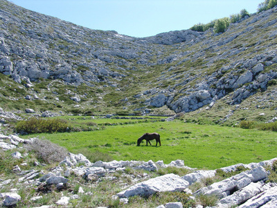
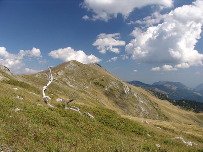
Under the peak of Prutaš in the massif of Durmitor (Montengro)
ALL MOUNTAIN AREAS, GROUPS AND UNITS PRESENTED IN THIS REGIONAL OVERVIEW AND ALL OTHER SECTIONS OF THIS PAGE, ARE STRUCTURED UPON A MIXTURE OF FACTORS, TO MAKE EVERYTHING FUNCTIONAL, PRACTICAL AND AT THE SAME TIME REAL - A WORK THAT INCLUDED COUNSELING A MYRIAD OF SOURCES OF ALL TYPES (SCIENTIFIC, TOURISTIC, OFFICIAL PLANS, ETC.), AND THIS DIVISION DOESN'T PRESENT OFFICIAL DIVISION OF THIS MOUNTAIN CHAIN - AS SUCH ONE (ONE COVERING ALL THE CHAIN) DOESN'T EXIST!
So, according to their morphology and their structure, the Dinaric Alps are being divided into 3 elongated, almost parallel BELTS (the term zone or chain could be also used) and then to geographical REGIONS:
So, according to their morphology and their structure, the Dinaric Alps are being divided into 3 elongated, almost parallel BELTS (the term zone or chain could be also used) and then to geographical REGIONS:
The Martime Belt
(The Southwestern Belt or Maritime Dinaric Alps)
I. Southwestern Belt or Maritime Belt (or Maritime Dinaric Alps) is characterized by predominance of limestone (from Cretaceous period) and flysch soils (from Eocene) which mostly fills tectonic depressions.
Geographical (mountainous) regions in Southwestern Belt are:
· Mountains of the Northern Adriatic
· Mountains of Dalmatia
· Mountains of Maritime and Central Montenegro (Deep Karst Area)
· Mountains of Lower Herzegovina
Geographical (mountainous) regions in Southwestern Belt are:
· Mountains of the Northern Adriatic
· Mountains of Dalmatia
· Mountains of Maritime and Central Montenegro (Deep Karst Area)
· Mountains of Lower Herzegovina
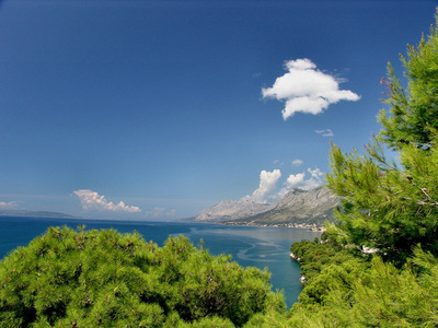
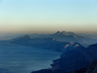
View from the peak of Vošac on Biokovo mountain in direction of mountains Omiška Dinara, Poljička planina and Mosor
(Dalmatia, Croatia)
(Dalmatia, Croatia)
View from Trojan peak on sharp peaks of Karanfili in Prokletije / Bjeshkët e Nemuna range. (Montenegro, Albania)
The Central Belt
(The Belt of high Dinaric Alps)
II. Central Belt or High Dinaric Alps is dominantly built of Mesozoic limestone (on surface from Creatceous, and in deep from Triassic periods) and dolomites, with basins made of lakes sediments from later Tertiary.
Geographical (mountainous) regions in Central Belt or High Dinarics are:
· Mountains of High Karstic Plateaus of Slovenia and Croatia
· Mountains of Lika Region in Croatia
· Mountains of Western Bosnia and Dinara
· Mountains of High Herzegovina
· Central Bosnian/Herzegovian mountains
· Površi and Brda (High Mountains and Plateaus Region in Montenegro) and Prokletije
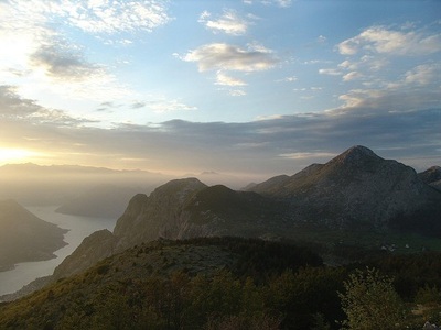
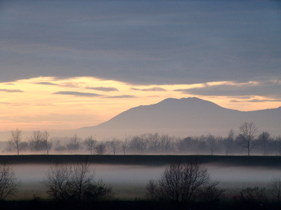
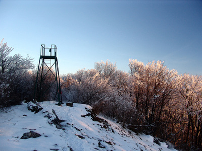
The effect of winter temperature inversion just before the sunset on the ridge of Plešivica in Samoborskom gorje (Samobor hills) (Croatia)
The Northeastern Belt
III. Northeastern Belt with the mountains of more complex structure. The most of them are built of paleosoic layers and different eruptive rocks. The older layers on northern edge of this zone are covered by sediments of old Pannonian sea. This is the area of nonporous layers with normal waterflows. On the northernmost part of this zone Dinaric Alps meet the Pannonian/Hungarian plain, and this is the area of low green mountains and hills build of later tertiary sediments.
Geographical (mountainous) regions in Northeastern Belt are:
· Mountains of Slovenian Dolenjska Region and NW Croatia
· Mountains of Central and Eastern Bosnia
· Mountains of Stari Vlah and Raška
· Mountains of North-Western Serbia
· Other Peri-Pannonian of Pre-Dinaric Mountains
Geographical (mountainous) regions in Northeastern Belt are:
· Mountains of Slovenian Dolenjska Region and NW Croatia
· Mountains of Central and Eastern Bosnia
· Mountains of Stari Vlah and Raška
· Mountains of North-Western Serbia
· Other Peri-Pannonian of Pre-Dinaric Mountains
From geological viewpoint it is usually said that the Dinarics are separated into two zones:
The southwestern one, known as External Dinarides of High Karst Area - in fact a thick limestone belt, which is dominated by karstic relief features and with rare surface water-flows, and
the Northeastern area, so called Internal Dinarides with normal relief and rich network of surface water-flows. The line that separates two geological zones goes approximately over Gacko, town - Konjic, town - Vitorog mt. line.
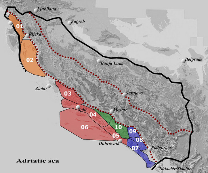
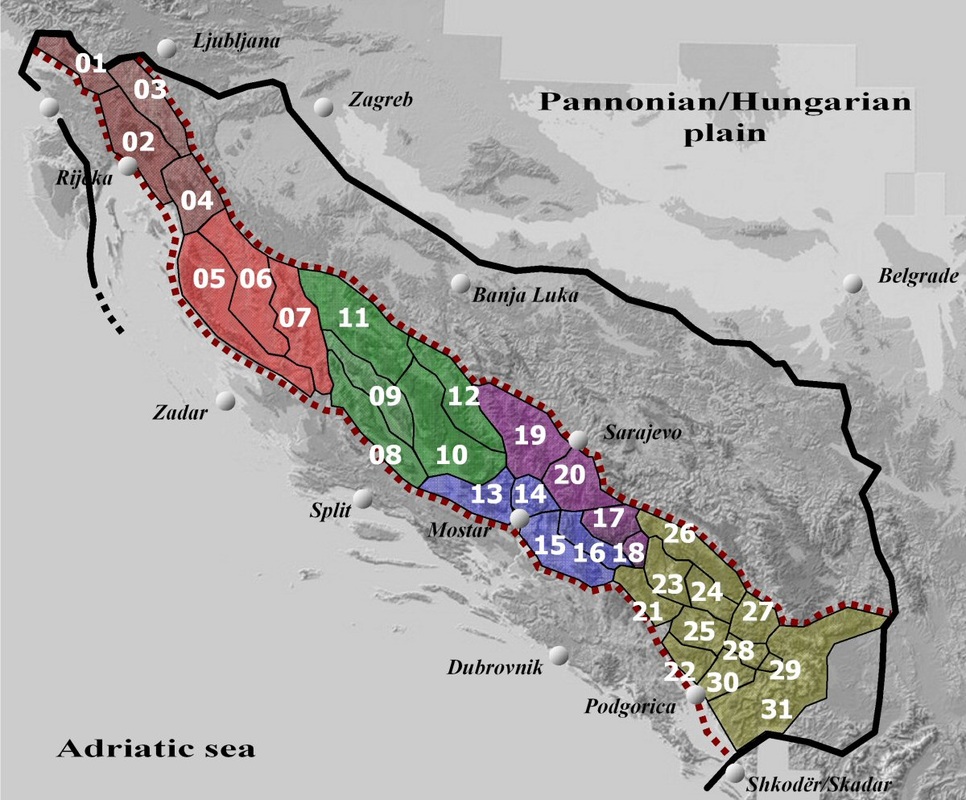
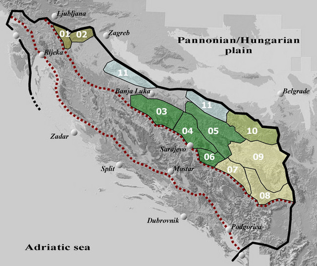
As colleagues from the French Wikipedia adopted my concept of division of the Dinaric Alps (that I had made few years earlier for the Summitpost page), and then for the purpose of Wikipedia they made a graphically better designed map of this division, that are my home-made maps, I have taken the opportunity to use that map as a basis for creating an Interactive map of the Dinaric Alps, presented bellow this text.
If you move the pointer over certain areas on the map - which represent mountain areas and groups (with the numbers that match with the numbers and the names of mountain groups, as are presented in the previous Chapter) - and by clicking on that part of the map, you will open a page of that specific mountain groups (but, for now these sites are in local Slavic languages of the Dinaric zone, only).
If you move the pointer over certain areas on the map - which represent mountain areas and groups (with the numbers that match with the numbers and the names of mountain groups, as are presented in the previous Chapter) - and by clicking on that part of the map, you will open a page of that specific mountain groups (but, for now these sites are in local Slavic languages of the Dinaric zone, only).
